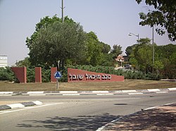
Kokhav Michael
Appearance
Kokhav Michael
כוכב מיכאל كوخاف ميخائيل | |
|---|---|
 Entrance to Kokhav Michael | |
| Coordinates: 31°37′44″N 34°40′10″E / 31.62889°N 34.66944°E | |
| Country | Israel |
| District | Southern |
| Council | Hof Ashkelon |
| Affiliation | Moshavim Movement |
| Founded | 1950 |
| Founded by | Iraqi immigrants |
| Population (2022)[1] | 1,122 |
Kokhav Michael (Template:Lang-he, lit. Star of Michael) is a moshav in southern Israel. Located between Kiryat Gat and Ashkelon,[2] it falls under the jurisdiction of Hof Ashkelon Regional Council. In 2022 it had a population of 1,122.[1]
History
The moshav was founded in 1950 by immigrants from Iraq on the land of the depopulated Palestinian village of Kawkaba[3] (from which the moshav takes the first part of its name; the second half is from Michael Sobell, a British philanthropist). They were joined by immigrants from Argentina in 1962.[citation needed])
References
- ^ a b "Regional Statistics". Israel Central Bureau of Statistics. Retrieved 21 March 2024.
- ^ My husband feels guilty for bringing me here, Jerusalem Post
- ^ *Khalidi, Walid (1992). All That Remains: The Palestinian Villages Occupied and Depopulated by Israel in 1948. Washington D.C.: Institute for Palestine Studies. p. 122. ISBN 0-88728-224-5.

