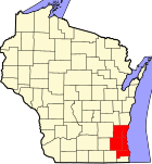
New Berlin, Wisconsin
New Berlin, Wisconsin | |
|---|---|
 Location in Wisconsin | |
| Country | United States |
| State | Wisconsin |
| County | Waukesha |
| Founded | January 13, 1840 |
| Incorporated | 1959 |
| Government | |
| • Mayor | Jack F. Chiovatero |
| Area | |
| • Total | 36.9 sq mi (95.6 km2) |
| • Land | 36.8 sq mi (95.4 km2) |
| • Water | 0.1 sq mi (0.2 km2) 0.22% |
| Elevation | 922 ft (281 m) |
| Population (2000) | |
| • Total | 38,220 |
| • Density | 1,037.4/sq mi (400.6/km2) |
| Time zone | UTC-6 (Central) |
| • Summer (DST) | UTC-5 (Central) |
| Postal Code | 53146, 53151 |
| Area code | 262 |
| FIPS code | 55-56375Template:GR |
| GNIS feature ID | 1570202Template:GR |
| Website | http://www.newberlin.org |
New Berlin is a city in Waukesha County, Wisconsin, United States. The population was 38,220 at the 2000 census. New Berlin is the third largest community in Waukesha County. The city was named for New Berlin, New York.
Pronunciation
Area residents put the accent on the first syllable of Berlin /nuːˈbɜrlɨn/, rather than on the second.
History
New Berlin was largely developed in the 1960s and 1970s, although it continues to see growth. The city was incorporated in 1959 and grew as a result of white flight from the City of Milwaukee and the migration of rural Wisconsinites to metropolitan Milwaukee. New Berlin contains several office parks and subdivisions.
The city's explosive growth and relatively poor planning have lead to a growing water crisis.[citation needed] The westernmost part of the city receives its water from private wells tapping any of several local aquifers. Much of the central part of the city receives water from deep city wells that draw from a deep sandstone aquifer; this water supply has been dropping and is contaminated with radium. The easternmost part of the city receives Lake Michigan water from Milwaukee. The city has made several attempts to acquire additional water from Lake Michigan, although negotiations have failed and the city is continues to seek a new long-term water source. The city has reached an agreement with the City of Milwaukee to expand its water purchases.[1]
Interstate 43 has been expanded at the Moorland Road exit in order to accommodate a growing number of commuters from the suburb. The new interchange has a two-lane roundabout that has been the center of a great deal of controversy because of the high number of accidents and traffic back-ups on Interstate 43[2].
Geography
New Berlin is located at 42°58′45″N 88°6′33″W / 42.97917°N 88.10917°WInvalid arguments have been passed to the {{#coordinates:}} function (42.979063, -88.109188).Template:GR The subcontinental divide cuts through the center of the city, with the eastern half receiving Lake Michigan water, while the western half uses well water. The headwaters of the Root River rise in the northeastern part of the city.
According to the United States Census Bureau, the city has a total area of 36.9 square miles (95.6 km²), of which, 36.8 square miles (95.4 km²) of it is land and 0.1 square miles (0.2 km²) of it (0.22%) is water.
Demographics
As of the censusTemplate:GR of 2000, there were 38,220 people, 14,495 households, and 11,045 families residing in the city. The population density was 1,037.4 people per square mile (400.6/km²). There were 14,921 housing units at an average density of 405.0/sq mi (156.4/km²). The racial makeup of the city was 95.84% White, 0.44% African American, 0.21% Native American, 2.31% Asian, 0.02% Pacific Islander, 0.45% from other races, and 0.72% from two or more races. Hispanic or Latino of any race were 1.56% of the population.
There were 14,495 households out of which 34.0% had children under the age of 18 living with them, 68.0% were married couples living together, 5.7% had a female householder with no husband present, and 23.8% were non-families. 19.0% of all households were made up of individuals and 7.0% had someone living alone who was 65 years of age or older. The average household size was 2.62 and the average family size was 3.03.
In the city the population was spread out with 24.8% under the age of 18, 6.4% from 18 to 24, 29.0% from 25 to 44, 27.1% from 45 to 64, and 12.7% who were 65 years of age or older. The median age was 40 years. For every 100 females there were 96.9 males. For every 100 females age 18 and over, there were 95.4 males.
The median income for a household in the city was $67,576, and the median income for a family was $75,565. Males had a median income of $50,405 versus $33,720 for females. The per capita income for the city was $29,789. About 1.3% of families and 2.0% of the population were below the poverty line, including 2.4% of those under age 18 and 3.1% of those age 65 or over.
Education
Schools in the School District of New Berlin system are:
- New Berlin Eisenhower Middle and High School
- New Berlin West Middle and High School
- Ronald Reagan Elementary (New school comprised with New Berlin Center and Prospect Hill)
- Poplar Creek Elementary
- Glen Park Elementary
- Orchard Lane Elementary
- Elmwood Elementary
There are two private elementary (K4-8) schools in New Berlin
Recreation
New Berlin has 17 public parks whose facilities include playing fields at Malone Park, near New Berlin's City Hall, and a disc golf course at Valley View Park, in the southeastern part of the city. [3]
References
- ^ "City of New Berlin 2006 Water Quality Report" (PDF). Retrieved 2008-04-08.
- ^ "Are roundabouts dangerous? So far, yes". Retrieved 200-09-01.
{{cite web}}: Check date values in:|accessdate=(help); Cite has empty unknown parameter:|1=(help) - ^ "Parks, Recreation & Forestry". Retrieved 2009-11-01.


