Teyseba
40°09′10″N 45°29′42″E / 40.15278°N 45.49500°E
| Teyseba Թեյշեբա | |
|---|---|
| Gegharkunik, Armenia | |
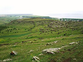
 Overlooking Teyseba and Lake Sevan. | |
| Lua error in Module:Location_map at line 425: No value was provided for longitude. | |
| Type | Fortress |
| Site information | |
| Open to the public | Yes |
| Condition | Ruins |
| Site history | |
| Built | Originally 735-713 BC; Rebuilt later. |
| Built by | Founded by Rusa I; Later rebuilt by another lord. |
| In use | Araratian-Medieval eras. |
Teyseba (Armenian: Թեյշեբա; later Odzaberd) is located east of the town of Tsovinar and at the south-east corner of Lake Sevan. It is an important archaeological site because it was once a fortified Urartian city founded by Rusa I between 735-713 BC, and is considered the best preserved Araratian (Urartian) fortification in the Sevan basin. Carved into the rock face on a low cliff at base of the hill which the city was built upon, is an ancient cuneiform inscription written by Rusa I. It relates that the city was built in dedication to the god Teisheba and also speaks of Rusa I conquest of twenty-three nations.

Local folklore tells that Lake Sevan was at a much higher elevation during this time, and that the city of Teyseba had been built along its shoreline. It is said that the cuneiform inscription was carved into the cliff face to prevent it from being defaced. Due to the water level being so much higher at the time, the location would have been virtually inaccessible. It is also believed that what is now a modern cemetery located on a rocky outcrop north of the village of Tsovinar, was during Araratian (Urartian) times an island with a small village that had been destroyed by lava flow that came up from below the lake. The island has since dwindled in size due to erosion.
Amongst the ruins, stone foundations and parts of the city wall and gates are still visible. There is also an entrance to a small cave located on the western face of the hill within the ruins of Teyseba.
References
- Kiesling, Brady (June 2000). Rediscovering Armenia: An Archaeological/Touristic Gazetteer and Map Set for the Historical Monuments of Armenia (PDF). Archived (PDF) from the original on 6 November 2021.
- Chahin, Mack (2001), The Kingdom of Armenia: New Edition (Caucasus World), Richmond, England: Curzon Press, ISBN 0700714529
