
Lund (Kristiansand)
This article needs additional citations for verification. (May 2015) |
Lund
Lund, Kristiansand | |
|---|---|
Borough of Kristiansand | |
 Gimle | |
 Coat of arms | |
 Location of Lund, shown in yellow, in Kristiansand | |
| Country | |
| County | |
| City | Kristiansand |
| Population (2015) | |
| • Total | 30,000 |
| ZIP Code prefix | 460*, 463*, 468*, 469* |
| Website | kristiansand.kommune.no |
Lund is a borough and a district in Kristiansand, Norway.

Lund district has a population of 20,000 (2013). It includes the boroughs Lund, Gimlekollen, Justvik and Ålefjær. The district is connected by E18 and it has boundaries with Søm (east), Kvadraturen/Eg (west) and Vennesla municipality (north).
Lund borough is a borough west for Søm, east for Kvadraturen and south for Gimlekollen. The borough includes Vige and Vollevannet. In 2013 the population at Lund was 15,950. There are a lot of shops and industries at Lund and it's an important part of Kristiansand. Telenor has their headquarter for Sørlandet at Lund, and the University of Agder is located there. Nearby the university is the cathedral high school of Kristiansand, "KKG" (Kristiansand Katedralskole Gimle) located. Other schools includes two junior highs and three elementary. Sør-Arena, the main arena for the city, is located southeast at Lund and it's the home to Kristiansand's football team IK Start. The old arena, Kristiansand Arena, is also located at Lund. Kristiansand Arena is today a public place for sports.
Lund Church and Oddemarka Church is the only churches at Lund. Oddemarka Church was one of the first churches to be built in Kristiansand. There are two bridges over to Kvadraturen: "Lundsbroa" and "Oddernesbrua". Before Oddernesbrua was Lundsbroa the main way to east. Today, Oddernesbrua is a part of the highway E18, the bridge ends in a tunnel. While Lundsbroa is a part of Riksvei 471, it ends in the city centrum of Lund. Public transportation is available with bus, all local busses headed eastbound has more than one stop at Lund. There is also buses that goes "deeper" in to Lund. Line 13 Grimsmyra-Lund goes to Kuholmen in Lund, a place south of Lund, while Line 19 Suldalen-Lund UiA, follows Riksvei 471 to the University.

| Nr | District | Population |
|---|---|---|
| 1 | Lund (Centrum) | 15,000 |
| 2 | Gimlekollen | 5,200 |
| 3 | Justvik | 2,700 |
| 4 | Ålefjær | 410 |
Neighborhoods
Transportation
Road

European route 18 is the main road and is a highway. While other roads like County Road 471 goes from the University to downtown Kristiansand. As for County Road 1 goes from Vennesla and ends in Lund centrum. County Road 1 goes next to Otra river.
| Route | Destination |
|---|---|
| E18 | Vige - Gimle - Downtown |
| Fv1 | Lund centrum - Sødal - Strai - Vennesla |
| Fv23 | Marvika - Oddemarka |
| Fv452 | Vige - Gimlekollen - Justvik - Ålefjær |
| Fv453 | Tveit - Ålefjær - Vennesla |
| Fv471 | Bjørndalssletta - Lund centrum - Downtown |
Bus

| Line | Destination [1] |
|---|---|
| 01 | Kvadraturen - Sørlandsparken |
| 13 | Grimsmyra - Lund |
| 19 | Suldalen - Lund-UiA |
| 40 | Søgne - Kristiansand - Lund |
| - | - |
| M1 | Flekkerøy - Sørlandsparken Dyreparken-IKEA |
| M2 | Voiebyen - Hånes (-Lauvåsen) |
| M2 | Voiebyen - Hånes - Kjevik/Tveit |
| M3 | Slettheia - Søm |
| A2 | Kvadraturen - Hånes |
| A3 | Kvadraturen - Søm |
| D2 | Voiebyen - Kvadraturen-UiA |
| D3 | Slettheia - Kvadraturen-UiA |
| 05 | Andøya - Kvadraturen-UiA |
| 09 | Bråvann - Kvadraturen-UiA |
| 15 | Tinnheia - Kvadraturen-UiA |
| 17 | Hellemyr - Tømmerstø |
| 17 | Hellemyr - Tømmerstø-Frikstad |
| 18 | Hellemyr - Tømmerstø Odderhei-Holte |
| 18 | Hellemyr - Dvergsnes |
| 22 | Kvadraturen - Gimlekollen-Jærnesheia |
| 22 | Kvadraturen - Gimlekollen - Ålefjær |
| 22 | Kvadraturen - Gimlekollen-Fagerholt |
| 23 | Kvadraturen - Vollevannet-Jærnesheia |
| 23 | Kvadraturen - Vollevannet-Ålefjær |
| 31 | Kristiansand - Vennesla |
| 32 | Høietun - Kvadraturen - UiA |
| 35 | Kristiansand - Kjevik-Brattvollshei |
| 35 | Kristiansand - Kjevik-Brattvollshei / Grødum |
| 36 | Kristiansand - Tveit-Grødum |
| 37 | Kristiansand - Birkeland |
| 40 | Søgne - Kristiansand - UiA |
| 42 | Søgne - Kristiansand - UiA |
| 43 | Greipstad - Kristiansand - UiA |
| 44 | Greipstad - Kristiansand - UiA |
| 45 | Greipstad - Kristiansand - UiA |
| 46 | Finsland - Kristiansand - UiA |
| 50 | Søgne - Kristiansand - UiA |
| 100 | Kristiansand - Arendal |
| 139 | Kristiansand Høvåg-Lillesand |
| 900 | Mandal - Kristiansand - UiA |
| 900 | Farsund-Lista - Kristiansand - UiA |
| FLY | Kristiansand - Kristiansand Airport, Kjevik |
| - | - |
| N2 | Flekkerøy-Voiebyen - Hånes |
| N3 | Slettheia - Søm |
| N17 | Kvadraturen - Tømmerstø |
Photos
-
 Lund church
 -
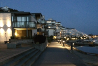 Lund shore
 -
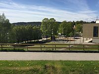
 Sør Arena
 -
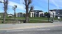
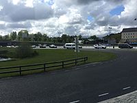
 Vollevannet
 -
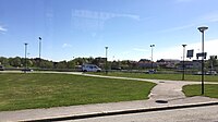
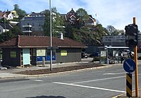 Lund torv
 -
 Oddemarka
 -
 Lovisenlund
 -
 Vige
Vige -
 Bjørndalsletta
 -
 Bjørndalsletta with Prestebekken
 -

-
 Lundsbroa from Kvadraturen to Lund


58°08′50″N 8°01′06″E / 58.14722°N 8.01833°E