
List of dams in the Columbia River watershed

What follows are lists of the dams that are found in the Columbia River watershed. Tributaries of the Columbia and their dammed tributaries, as well as the main stem itself, each have their own list. The dams are listed in the order as they are found from source to terminus. Many of the dams in the Columbia River watershed are not created for water storage or flood protection. Instead, the primary purpose of these dams is hydroelectric power production. As can be seen in the lists, these dams provide a relatively significant amount of power.
Major dam construction began in the early 20th century, and finished toward the end of the same century. Including just the dams listed below, there are sixty dams in the watershed, with fourteen on the Columbia, twenty on the Snake, seven on the Kootenay, seven on the Pend Oreille / Clark, two on the Flathead, eight on the Yakima, and two on the Owyhee. Averaging a major dam every seventy-two miles, the rivers in the Columbia watershed combine to create over 36,000 megawatts of power, with the majority coming on the main stem. Grand Coulee Dam is the largest producer of hydroelectric power in the nation,[1] creating 6,809 megawatts, over one-sixth of all power in the basin.
In addition to providing ample power for the people of the Pacific Northwest, the reservoirs created by the dams have created numerous recreational opportunities, including fishing, boating, and windsurfing. Furthermore, by creating a constant flow and consistent depth along the river channel, the series of locks and dams have allowed for Lewiston, Idaho to become the furthest inland seaport on the west coast of the United States.[2] Despite the numerous benefits to humans that the dams have given, a number of environmental consequences have manifested as a result of the dams, including a negative impact on salmonid populations of the basin.[3]
The organization of the following lists begins with the Columbia and is followed by its tributaries in order of length. Additionally, the table of contents below is indented to indicate tributary status of each river.
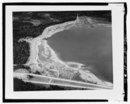
Mainstream Columbia River Dams


.jpg)


.jpg)


Snake River Dams
Note: Dams are listed in order from headwater (Jackson Lake, WY) to mouth (Columbia River, WA).


Owyhee River Dams
Note: Dams are listed in order from headwater (northeastern Nevada) to mouth (Snake River, OR)
| Name | Height | Capacity (MW) | Province/State(s) | Coordinates | Year of Completion | Owner | Reservoir Formed | Dam Picture |
|---|---|---|---|---|---|---|---|---|
| Wild Horse Dam | 101 ft (31 m)[55] | 0 | 41°41′14″N 115°50′43″W / 41.68722°N 115.84528°W | 1937 / 1969[n 16] | BIA[57] | Wild Horse Reservoir | 
| |
| Owyhee Dam | 417 ft (127 m)[58] | 4.3[59] | 43°38′31″N 117°14′33″W / 43.64194°N 117.24250°W | 1932[58] | USBR | Lake Owyhee | 
|
Kootenay River Dams
Note: Dams are listed in order from headwater (Canadian Rockies) to mouth (Columbia River, BC).
_1986.jpg)


Note: Dams are listed in order from headwater of Clark Fork River (Southwestern Montana) to mouth of Pend Oreille River (Columbia River, BC).[n 20]

.jpg)


Flathead River Dams
Note: Dams are listed in order from headwater (Canadian Rockies) to mouth (Clark Fork River).[n 21]
| Name | Height | Capacity (MW) | Province/State(s) | Coordinates | Year of Completion | Owner | Reservoir Formed | Dam Picture |
|---|---|---|---|---|---|---|---|---|
| Hungry Horse Dam[n 22] | 564 ft (172 m)[79] | 428[80] | 48°20′28″N 114°00′47″W / 48.34111°N 114.01306°W | 1953[81] | USBR | Hungry Horse Reservoir | 
| |
| Kerr Dam | 205 ft (62 m)[82] | 188[83] | 47°40′38″N 114°14′02″W / 47.67722°N 114.23389°W | 1938[81] | PPL/Tribal | Raised Flathead Lake 10 ft (3.0 m)[81] | 
|
Yakima River Dams
Note: Dams are listed in order from headwater (Keechelus Lake) to mouth (Columbia River, WA).


Willamette River Dam
| Name | Height | Capacity (MW) | Province/State(s) | Coordinates | Year of Completion | Owner | Reservoir Formed | Dam Picture |
|---|---|---|---|---|---|---|---|---|
| Willamette Falls Dam | 20 ft (6.1 m)[94] | 15.18[95] | 45°21′11″N 122°37′04″W / 45.35306°N 122.61778°W | 1888[15] | Portland General Electric | 
|
Santiam River Dams
| Name | Height | Capacity (MW) | Province/State(s) | Coordinates | Year of Completion | Owner | Reservoir Formed | Dam Picture |
|---|---|---|---|---|---|---|---|---|
| Big Cliff Dam (North Santiam) | 44°45′03″N 122°16′59″W / 44.75083°N 122.28306°W | 1953 | Army Corps of Engineers | Big Cliff Reservoir (reregulation for Detroit Reservoir) | ||||
| Detroit Dam | 44°43′18″N 122°15′01″W / 44.72167°N 122.25028°W | 1953 | Army Corps of Engineers | Detoit Reservoir | ||||
| Foster Dam (South Santiam) | 44°24′55″N 122°40′13″W / 44.41528°N 122.67028°W | 1968 | Army Corps of Engineers | Foster Reservoir (reregulation for Green Peter Reservoir) | ||||
| Green Peter Dam | 44°27′00″N 122°32′57″W / 44.45000°N 122.54917°W | 1968 | Army Corps of Engineers | Green Peter Reservoir |
Note: Dams are listed in order from headwater to mouth
| Name | Height | Capacity (MW) | Province/State(s) | Coordinates | Year of Completion | Owner | Reservoir Formed | Dam Picture |
|---|---|---|---|---|---|---|---|---|
| Hills Creek Dam | 304 ft (93 m)[96] | 30[96] | 43°42′33″N 122°25′26″W / 43.70917°N 122.42389°W | 1961[96] | USACE | Hills Creek Reservoir | 
| |
| Lookout Point Dam | 276 ft (84 m)[97] | 150[97] | 43°54′48″N 122°45′09″W / 43.91333°N 122.75250°W | 1954[97] | USACE | Lookout Point Lake | 
| |
| Fall Creek Dam | 43°54′49″N 122°45′25″W / 43.91361°N 122.75694°W | 1966 | Army Corps of Engineers | Fall Creek Reservoir | ||||
| Dexter Dam | 93 ft (28 m)[97] | 15[97] | 43°55′22″N 122°48′23″W / 43.92278°N 122.80639°W | 1954[97] | USACE | Dexter Reservoir | 
|
McKenzie River Dams
Note: Dams are listed in order from headwater (Clear Lake) to mouth (Willamette River)).
| Name | Height | Capacity (MW) | Province/State(s) | Coordinates | Year of Completion | Owner | Reservoir Formed | Dam Picture |
|---|---|---|---|---|---|---|---|---|
| Carmen Diversion Dam | 44°20′19″N 122°00′11″W / 44.33861°N 122.00306°W | Eugene Water & Electric Board | Carmen Reservoir | |||||
| Trail Bridge Dam | 10[98] | 44°16′24″N 122°03′02″W / 44.27333°N 122.05056°W | Eugene Water & Electric Board | Trail Bridge Reservoir | ||||
| Cougar Dam | 44°07′44″N 122°14′30″W / 44.12889°N 122.24167°W | 1963 | Army Corps of Engineers | Cougar Reservoir | ||||
| Blue River Dam | 44°10′23″N 122°19′47″W / 44.17306°N 122.32972°W | 1969 | Army Corps of Engineers | Blue River Reservoir | ||||
| Leaburg Dam | 25[99] | 44°08′15″N 122°36′43″W / 44.13750°N 122.61194°W | 1929[99] | Eugene Water & Electric Board | Leaburg Reservoir | _(lanDA0035).jpg)
|
| Name | Height | Capacity (MW) | Province/State(s) | Coordinates | Year of Completion | Owner | Reservoir Formed | Dam Picture |
|---|---|---|---|---|---|---|---|---|
| Cottage Grove Dam | 95 ft (29 m)[100] | 0 | 43°42′58″N 123°03′03″W / 43.71611°N 123.05083°W | 1942[100] | USACE | Cottage Grove Lake | 
|
Spokane River Dams
Note: Dams are listed in order from headwater (Lake Coeur d'Alene) to mouth (Columbia River, WA).


Cowlitz River Dams
Note: Dams are listed in order from headwater (Cascade Mountains) to mouth (Columbia River, WA)
| Name | Height | Capacity (MW) | Province/State(s) | Coordinates | Year of Completion | Owner | Reservoir Formed | Dam Picture |
|---|---|---|---|---|---|---|---|---|
| Cowlitz Falls Dam | 140 ft (43 m)[110] | 70[111] | 46°27′59″N 122°06′33″W / 46.46639°N 122.10917°W | 1994[111] | Bonneville Power Administration | Lake Scanewa | ||
| Mossyrock Dam | 606 ft (185 m)[112] | 300[112] | 46°32′04″N 122°25′29″W / 46.53444°N 122.42472°W | 1968[112] | Tacoma Public Utilities | Riffe Lake | 
| |
| Mayfield Dam | 250 ft (76 m)[113] | 162[113] | 46°30′10″N 122°35′18″W / 46.50278°N 122.58833°W | 1963[113] | Tacoma Public Utilities | Lake Mayfield |
Chelan River Dam
| Name | Height | Capacity (MW) | Province/State(s) | Coordinates | Year of Completion | Owner | Reservoir Formed | Dam Picture |
|---|---|---|---|---|---|---|---|---|
| Lake Chelan Dam | 40 ft (12 m)[114] | 59.2[114] | 47°50′04″N 120°00′45″W / 47.83444°N 120.01250°W | 1892-1903 / 1927[n 24] | Chelan County Public Utility District | Raised Lake Chelan | .jpg)
|
Clearwater River (North Branch)
| Name | Height | Capacity (MW) | Province/State(s) | Coordinates | Year of Completion | Owner | Reservoir Formed | Dam Picture |
|---|---|---|---|---|---|---|---|---|
| Dworshak Dam | 717 ft (219 m)[115] | 400 | 46°30′N 116°18′W / 46.500°N 116.300°W | 1973 | Army Corps of Engineers | Dworshak Reservoir |
See also
- List of lakes in Washington (state)
- List of tallest dams in the world
- Dams in the Colorado River system
- Hydroelectricity
- List of reservoirs and dams in the United States
- Columbia River Treaty (US–Canadian treaty regulating hydroelectric development)
Notes
- ^ Dam was initially completed in 1941; third power plant was begun in 1967 and completed in 1974.[9]
- ^ The original dam was completed in 1911. In 1917, the dam was raised 17.5 feet to increase storage. Later, safety concerns were addressed and the new, modified dam was completed in 1989.[25]
- ^ Original dam was completed in 1927. Due to deterioration, a replacement dam was commissioned and completed in 1978.[29]
- ^ Information received in email exchange with representative from Idaho Power.
- ^ Initially completed in 1935, updated in 1995 with diversion structure and two powerhouses[33]
- ^ Information received in email exchange with representative from Idaho Power.
- ^ Information received in email exchange with representative from Idaho Power.
- ^ Constructed with two power plants - A & B. Upper Salmon A was completed in 1937, Upper Salmon B, located a mile upriver from A, was completed in 1947.[33]
- ^ Information received in email exchange with representative from Idaho Power.
- ^ Initially constructed by Greater Shoshone and Twin Falls Water Power Company in 1910, bought by Idaho Power in 1916 and updated in 1949.[33]
- ^ A new power plant was built in the 1990s; this one was decommissioned and turned into a historical display[39]
- ^ Information received in email exchange with representative from Idaho Power.
- ^ Dam and units one to four completed in 1959, unit five completed in 1980.[41]
- ^ Dam and first three powerhouses were completed in 1975. Three further powerhouses, as well as modifications to Lewiston's water intake, were completed in 1987.[48]
- ^ Dam was initially completed in 1961 with three generators online. Powerhouse units four through six were later added and online in 1976.[53]
- ^ The first Wild Horse Dam was constructed in 1937. After the aggregate was found to be of poor quality, a new concrete, thin arch dam was completed in 1969, doubling the size of the reservoir.[56]
- ^ Kootenay Canal Generating Station is located at the end of a canal created by the Corra Linn Dam.
- ^ Original dam constructed in 1944 created 140 MW; Expansion completed in 2007 added 120 MW.[8]
- ^ Original dam constructed in 1944 created 140 MW; Expansion completed in 2007 added 120 MW.[8]
- ^ Although these rivers are not one, for the simplification of this list they will be listed together, as they are only separated by Lake Pend Oreille.
- ^ All forks of Flathead River are treated as being on main stem, as there is only one dam on any of the forks.
- ^ On South Fork of Flathead River
- ^ Originally constructed in 1894, upgraded to concrete structure in 1933, with significant upgrades in the 1980s.[102]
- ^ Beginning in 1892, dams were constructed at the mouth of Lake Chelan. After two failures, a more robust dam was constructed in 1903, providing electricity to Chelan. The current dam was completed in 1927.[114]
References
- ^ U.S. Energy Information Administration (2014-11-14). "Renewable Energy Explained". Retrieved 2015-01-03.
- ^ Idaho Transportation Department (2005). "Inside the Idaho Transportation Department" (PDF). Retrieved 2015-01-03.
- ^ U.S. Department of Energy (1994). "A REVIEW OF THE EFFECTS OF DAMS ON THE COLUMBIA RIVER ESTUARINE ENVIRONMENT, WITH SPECIAL REFERENCE TO SALMONIDS" (PDF). Retrieved 2015-01-03.
- ^ Center for the Columbia River History. "Dams of the Columbia Basin & Their Effects on the Native Fishery". Retrieved 2015-01-03.
- ^ a b BC Hydro (2014). "Columbia Region". Retrieved 2015-01-03.
- ^ Ministry of Energy, Mines and Natural Gas (2012-12-05). "A Review of the Range of Impacts and Benefits of the Columbia River Treaty on Basin Communities, the Region and the Province" (PDF). Retrieved 2015-01-03.
- ^ BC Hydro (2014). "Hugh Keenleyside Dam". Retrieved 2015-01-03.
- ^ a b c d e f g h i j k Columbia Basin Trust (2012). "Columbia River Basin: Dams and Hydroelectricity" (PDF). Retrieved 2015-01-03.
- ^ a b c United States Bureau of Reclamation (2012). "Grand Coulee Dam and Statistics" (PDF). Retrieved 2015-01-03.
- ^ Fundamentals of Renewable Energy. "Chief Joseph Dam Hydroelectric Power Plant" (PDF). Retrieved 2015-01-03.
- ^ Columbia Basin Research. "Chief Joseph Dam - Hydroelectric Project Information". Retrieved 2015-01-03.
- ^ Columbia Basin Research. "Wells Dam - Hydroelectric Project Information". Retrieved 2015-01-03.
- ^ Columbia Basin Research. "Rocky Reach Dam - Hydroelectric Project Information". Retrieved 2015-01-03.
- ^ Columbia Basin Research. "Rock Island Dam - Hydroelectric Project Information". Retrieved 2015-01-03.
- ^ a b The Northwest Power and Conservation Council (2013-11-13). "A Guide to Major Hydropower Dams of the Columbia River Basin". Retrieved 2015-01-06.
- ^ a b Grant PUD (2015). "WANAPUM DAM". Retrieved 2015-01-03.
- ^ Grant PUD (2015). "PRIEST RAPIDS DAM". Retrieved 2015-01-03.
- ^ Columbia Basin Research. "Priest Rapids Dam - Hydroelectric Project Information". Retrieved 2015-01-03.
- ^ United States Army Corps of Engineers. "McNary Lock and Dam". Retrieved 2015-01-03.
- ^ Columbia Basin Research. "McNary Dam - Hydroelectric Project Information". Retrieved 2015-01-03.
- ^ Columbia Basin Research. "John Day Dam - Hydroelectric Project Information". Retrieved 2015-01-03.
- ^ Columbia Basin Research. "The Dalles Dam - Hydroelectric Project Information". Retrieved 2015-01-03.
- ^ United States Corps of Engineers. "The Bonneville Lock and Dam Fact Sheet" (PDF). Retrieved 2015-01-03.
- ^ Columbia Basin Research. "Bonneville Dam - Hydroelectric Project Information". Retrieved 2015-01-03.
- ^ a b United States Bureau of Reclamation (2012-10-29). "Jackson Lake Dam". Retrieved 2015-01-03.
- ^ National Parks Conservation Association. "Hydropower Production in Grand Teton". Retrieved 2015-01-06.
- ^ a b United States Bureau of Reclamation (2012-10-25). "Palisades Dam". Retrieved 2015-01-03.
- ^ Idaho Falls Power. "Idaho Falls Power Hydroelectric Project". Retrieved 2015-01-03.
- ^ a b United States Bureau of Reclamation (2012-10-25). "American Falls Dam". Retrieved 2015-01-03.
- ^ U.S. Department of the Interior (1994). "Resource Management Plan" (PDF). Retrieved 2015-01-03.
- ^ a b c United States Bureau of Reclamation (2012-11-26). "Minidoka Dam". Retrieved 2015-01-03.
- ^ Idaho State Historical Society Reference Series (1985). "Milner Dam" (PDF). Retrieved 2015-01-03.
- ^ a b c d e f g Idaho Power. "Decision Support Systems" (PDF). Retrieved 2015-01-03.
- ^ Idaho Power. "Hydroelectric Plants". Retrieved 2015-01-05.
- ^ "The History of Shoshone Falls Dam". 2011-07-10. Retrieved 2015-01-05.
- ^ a b Idaho Power (August 2005). "Initial Consultation Document: Shoshone Falls Hydroelectric Project" (PDF). Retrieved 2015-01-05.
- ^ a b Hydropower Reform Coalition & River Management Society (April 2013). "Hydropower Project Summary - Mid-Snake River, Idaho" (PDF). Retrieved 2015-01-05.
- ^ a b Idaho Power. "C. J. Strike Project". Retrieved 2015-01-03.
- ^ Idaho Power. "Swan Falls". Retrieved 2015-01-03.
- ^ Idaho Power. "Decision Support Systems" (PDF). Retrieved 2015-01-03.
- ^ a b Columbia Basin Research. "Brownlee Dam - Hydroelectric Project Information". Retrieved 2015-01-03.
- ^ Idaho Power. "Decision Support Systems" (PDF). Retrieved 2015-01-03.
- ^ Columbia Basin Research. "Oxbow Dam - Hydroelectric Project Information". Retrieved 2015-01-03.
- ^ Idaho Power. "Decision Support Systems" (PDF). Retrieved 2015-01-03.
- ^ Columbia Basin Research. "Hells Canyon Dam - Hydroelectric Project Information". Retrieved 2015-01-03.
- ^ United States Army Corps of Engineers. "Lower Granite Lock and Dam". Retrieved 2015-01-03.
- ^ Columbia Basin Research. "Lower Granite Dam - Hydroelectric Project Information". Retrieved 2015-01-03.
- ^ United States Corps of Engineers. "Lower Granite Lock and Dam". Retrieved 2015-01-03.
- ^ United States Army Corps of Engineers. "Little Goose Lock and Dam". Retrieved 2015-01-03.
- ^ Columbia Basin Research. "Little Goose Dam - Hydroelectric Project Information". Retrieved 2015-01-03.
- ^ United States Corps of Engineers. "Lower Monumental Lock and Dam". Retrieved 2015-01-03.
- ^ Columbia Basin Research. "Lower Monumental Dam - Hydroelectric Project Information". Retrieved 2015-01-03.
- ^ a b United States Corps of Engineers. "Ice Harbor Lock and Dam". Retrieved 2015-01-03.
- ^ Columbia Basin Research. "Ice Harbor Dam - Hydroelectric Project Information". Retrieved 2015-01-03.
- ^ State of Nevada (2011-08-26). "State of Nevada – Certificate of Appropriation of Water" (PDF). Retrieved 2015-01-11.
- ^ U.S. Department of the Interior (1973). "Bathymetric Reconnaissance of Wildhorse Reservoir, Elko County, Nevada" (PDF). Retrieved 2015-01-11.
- ^ Department of the Interior - U.S. Fish and Wildlife Service (2002-05-28). "Report to the Office of Management and Budget on the U.S. Fish and Wildlife Service's Fisheries Mitigation Program" (PDF). Retrieved 2015-01-11.
- ^ a b United States Bureau of Reclamation. "Owyhee Project" (PDF). Retrieved 2015-01-11.
- ^ Foundation for Water & Energy Education. "Owyhee Dam". Retrieved 2015-01-11.
- ^ United States Army Corps of Engineers (2013-05-24). "Libby Dam Visitor Center hours and tours reduced for Summer 2013". Retrieved 2015-01-06.
- ^ United States Army Corps of Engineers. "Libby Dam and Lake Koocanusa". Retrieved 2015-01-06.
- ^ USACE & Bonneville Power Administration (February 2009). "Columbia River Treaty: History and 2014/2024 Review" (PDF). Retrieved 2015-01-06.
- ^ a b c FortisBC. "Electricity facilities & operations". Retrieved 2015-01-06.
- ^ Touchstone Nelson: Museum of Art and History (2007). "Upper Bonnington Dam". Retrieved 2015-01-06.
- ^ Touchstone Nelson: Museum of Art and History (2007). "Lower Bonnington Dam". Retrieved 2015-01-06.
- ^ Touchstones Nelson:Museum of Art and History (2007). "South Slocan Dam". Retrieved 2015-01-07.
- ^ Waymarking (2013-06-10). "Kootenay Canal Dam - Bonnington Falls, BC". Retrieved 2015-01-07.
- ^ Touchstone Nelson: Museum of Art and History (2007). "Brilliant Dam". Retrieved 2015-01-07.
- ^ a b c d e f g Kalispel Natural Resource Department (2014-03-09). "Yes, It's Happening…..Fish Passage on 6 Dams in the Pend Oreille & Clark Fork Rivers for Resident Fish" (PDF). Retrieved 2015-01-09.
- ^ Avista Corporation (2007-10-31). "Application of Avista Corp" (PDF). Retrieved 2015-01-09.
- ^ Montana Department of Fish, Wildlife and Parks (April 1985). "Wildlife and Wildlife Habitat Mitigation Plan for the Nixon Rapids and Cabinet Gorge Hydroelectric Projects". Retrieved 2015-01-09.
- ^ Idaho Public Television. "Cabinet Gorge Dam". Retrieved 2015-01-09.
- ^ a b The Office of the Governor (2012-11-12). "60th Anniversary of Cabinet Gorge Dam" (PDF). Retrieved 2015-01-09.
- ^ United States Army Corps of Engineers (October 2011). "Albeni Falls Dam Flexible Winter Power Operations Bonner County, Idaho" (PDF). Retrieved 2015-01-09.
- ^ Foundation for Water & Energy Education. "Box Canyon: Pend Oreille River, WA". Retrieved 2015-01-09.
- ^ a b c United States Corps of Engineers North Pacific Division (November 1995). "Columbia River System Operation Review: Final Environmental Impact Statement" (PDF). Retrieved 2015-01-09.
- ^ Touchstones Nelson: Museum of Art and History (2007). "Seven Mile Dam". Retrieved 2015-01-09.
- ^ United States Army Corps of Engineers (October 2011). "Albeni Falls Dam Flexible Winter Power Operations Bonner County, Idaho" (PDF). Retrieved 2015-01-09.
- ^ United States Bureau of Reclamation (2013-10-13). "Hungry Horse Dam". Retrieved 2015-01-09.
- ^ United States Bureau of Reclamation (2013-10-21). "Hungry Horse Powerplant". Retrieved 2015-01-09.
- ^ a b c United States Corps of Engineers North Pacific Division (November 1995). "Columbia River System Operation Review: Final Environmental Impact Statement" (PDF). Retrieved 2015-01-09.
- ^ High Country News (2013-11-25). "Montana Tribes will be First to own a Hydroelectric Dam". Retrieved 2015-01-09.
- ^ Confederated Salish and Kootenai Tribes of the Flathead Nation. "Acquisition of Kerr Dam & Establishment of Wholesale Power Generation Corporation" (PDF). Retrieved 2015-01-09.
- ^ a b c United States Bureau of Reclamation (2013-01-03). "Yakima Project". Retrieved 2015-01-10.
- ^ a b c Oregon Public Broadcasting (2011-09-13). "As dams come down, a new look at hydropower". Retrieved 2015-01-10.
- ^ United States Bureau of Reclamation (2009-03-27). "Easton Diversion Dam - Dimensions". Retrieved 2015-01-10.
- ^ United States Bureau of Reclamation (2009-03-27). "Easton Diversion Dam - General". Retrieved 2015-01-10.
- ^ United States Bureau of Reclamation (2012-07-09). "Roza Diversion Dam - Dimensions". Retrieved 2015-01-10.
- ^ United States Bureau of Reclamation (2012-07-09). "Roza Diversion Dam - General". Retrieved 2015-01-10.
- ^ Department of Ecology (June 1991). "Wapato Dam Hydrologic Analysis" (PDF). Retrieved 2015-01-10.
- ^ Sunnyside Valley Irrigation District. "Facts and Figures: Sunnyside Division" (PDF). Retrieved 2015-01-10.
- ^ a b U.S. Fish and Wildlife Service (2012). "Passage of Radio-Tagged Adult Pacific Lamprey at Yakima River Diversion Dams" (PDF). Retrieved 2015-01-10.
- ^ a b U.S. Fish and Wildlife Service (2012). "Passage of Radio-Tagged Adult Pacific Lamprey at Yakima River Diversion Dams" (PDF). Retrieved 2015-01-10.
- ^ Gabriela Goldfarb Consulting (2008-02-14). "Final Application Reviewer Report for the Willamette Falls Hydroelectric Project" (PDF). Retrieved 2015-01-11.
- ^ Low Impact Hydropower Institute. "LIHI Certificate #33 – Willamette Falls Hydroelectric Project, Oregon". Retrieved 2015-01-11.
- ^ a b c United States Army Corps of Engineers (2009). "Hills Creek Lake, Oregon" (PDF). Retrieved 2015-01-11.
- ^ a b c d e f United States Army Corps of Engineers (2009). "Lookout Point Lake and Dexter Lake, Oregon" (PDF). Retrieved 2015-01-11.
- ^ United States Department of Agriculture - Forest Service. "Carmen-Smith Hydroelectric Project Area Map". Retrieved 2015-01-11.
- ^ a b Eugene Water & Electric Board. "Leaburg-Walterville Hydroelectric Project". Retrieved 2015-01-11.
- ^ a b United States Army Corps of Engineers (2009). "Cottage Grove Lake and Dorena Lake, Oregon" (PDF). Retrieved 2015-01-11.
- ^ a b c Avista. "Post Falls Hydroelectric Development". Retrieved 2015-01-11.
- ^ a b Spokane Public Works and Utilities. "Upriver Dam". Retrieved 2015-01-11.
- ^ a b c Avista. "Upper Falls Hydroelectric Development". Retrieved 2015-01-11.
- ^ a b c Avista. "Monroe Street Hydroelectrical Development". Retrieved 2015-01-11.
- ^ a b c Avista. "Nine Mile Hydroelectric Development". Retrieved 2015-01-11.
- ^ a b c Avista. "Long Lake Hydroelectric Development". Retrieved 2015-01-11.
- ^ Avista Corporation (July 2005). "Spokane River Hydroelectric Project" (PDF). Retrieved 2015-01-11.
- ^ Avista. "Little Falls Discharge". Retrieved 2015-01-11.
- ^ Northwest Council (2008-10-31). "Spokane River". Retrieved 2015-01-11.
- ^ Lewis County PUD (2013). "Cowlitz Falls Project". Retrieved 2015-01-11.
- ^ a b Moody’s Investor Service (2013-05-30). "Moody's assigns Aa1 rating to BPA backed Cowlitz Falls Hydro debt" (PDF). Retrieved 2015-01-11.
- ^ a b c Tacoma Public Utilities. "Mossyrock Dam". Retrieved 2015-01-11.
- ^ a b c Tacoma Public Utilities. "Mayfield Dam". Retrieved 2015-01-11.
- ^ a b c Hydropower Reform Coalition (2009). "Hydropower Reform Coalition Success Story" (PDF). Retrieved 2015-01-12.
- ^ "Dworshak Dam and Reservoir". U.S. Army Corps of Engineers. U.S. Army Corps of Engineers. Retrieved 9 September 2015.
External links
- Erik Robinson (April 15, 2007). "Pressure builds on Snake River dams". The Columbian.

- Dams on the Columbia River
- Lists of dams in the United States
- Hydroelectric power stations in British Columbia
- Hydroelectric power plants in Oregon
- Hydroelectric power plants in Washington (state)
- Lists of landforms of Washington (state)
- Lists of landforms of Oregon
- British Columbia-related lists
- Lists of buildings and structures in Washington (state)
- Lists of buildings and structures in Oregon