Marcellinara
Marcellinara | |
|---|---|
| Comune di Marcellinara | |
| Coordinates: 38°56′N 16°30′E / 38.933°N 16.500°E | |
| Country | Italy |
| Region | Calabria |
| Province | Catanzaro (CZ) |
| Area | |
| • Total | 20 km2 (8 sq mi) |
| Elevation | 337 m (1,106 ft) |
| Population (31 December 2013)[2] | |
| • Total | 2,304 |
| • Density | 120/km2 (300/sq mi) |
| Demonym | Marcellinaresi |
| Time zone | UTC+1 (CET) |
| • Summer (DST) | UTC+2 (CEST) |
| Postal code | 88044 |
| Dialing code | 0961 |
| Patron saint | San Francesco da Paola |
| Saint day | 2 April |
| Website | Official website |
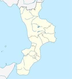
Marcellinara is a comune and town in the province of Catanzaro in the Calabria region of southern Italy.
History
This section is empty. You can help by adding to it. (July 2010) |
Geography
Marcellinara is located in the middle of the narrowest strip (Istmus)of Italy and one of the narrowest of Europe as well, between the Ioanian and the Tyhrennean seas, whose distance between them is only 40 km.
Where in the same time – in one shot – you can enjoy the view over two different seas! The Ionian on the East side, the Tyrrhenian on the opposite one. Sunrise and sunset over the sea without moving!
It is located close to both the regional capital of Catanzaro and the international airport of Lamezia Terme.
Three main hospitals are in Lamezia Terme and Catanzaro, at 15/20 minutes each.
Transport
The village is just 20 minutes far away from Lamezia Terme international airport, from Lamezia Terme Centrale railway station and from the A3 Salerno-Reggio Calabria high-way exit of the same Lamezia Terme. It is also 15 minutes away from the train station of Catanzaro Lido and 10 minutes from the SS 106 Taranto-Reggio Calabria exit. A railway bridge between here and Feroleto was washed away by flood waters in 2011.[3]
Notes and references
This article needs additional citations for verification. (September 2014) |
- ^ "Superficie di Comuni Province e Regioni italiane al 9 ottobre 2011". Italian National Institute of Statistics. Retrieved 16 March 2019.
- ^ "Popolazione Residente al 1° Gennaio 2018". Italian National Institute of Statistics. Retrieved 16 March 2019.
- ^ Today's Railway Europe 213, pg 55


