
St. Vincent, Minnesota: Difference between revisions
Trishymouse (talk | contribs) No edit summary |
Trishymouse (talk | contribs) No edit summary |
||
| Line 76: | Line 76: | ||
== History == |
== History == |
||
St. Vincent, which is directly across the Red River from [[Pembina, North Dakota|Pembina]], was initially incorporated in 1857, just prior to statehood. In 1878, the [[St. Paul & Pacific Railroad]] line reached St. Vincent and opened the area to settlement. With the railroad coming through, settlers began arriving to stake their claims. Many of the earliest settlers to what would become Pembina and St. Vincent were [[Métis in the United States|Métis]], going back to the late 18th century. |
St. Vincent, which is directly across the Red River from [[Pembina, North Dakota|Pembina]], was initially incorporated in 1857,<ref>{{Cite book |last=Upham |first=Warren |title=Minnesota Place Names: A Geographical Encyclopedia |publisher=Minnesota Historical Society Press |year=2001 |isbn=9780873513968, 0873513967 |edition=3rd, Revised |pages=293}}</ref> just prior to statehood. In 1878, the [[St. Paul & Pacific Railroad]] line reached St. Vincent and opened the area to settlement. With the railroad coming through, settlers began arriving to stake their claims. Many of the earliest settlers to what would become Pembina and St. Vincent were [[Métis in the United States|Métis]], going back to the late 18th century. |
||
==Geography== |
==Geography== |
||
Revision as of 20:12, 20 August 2022
St. Vincent | |
|---|---|
 Location of St. Vincent, Minnesota | |
| Coordinates: 48°58′6″N 97°13′34″W / 48.96833°N 97.22611°W | |
| Country | United States |
| State | Minnesota |
| County | Kittson |
| Area | |
| • Total | 1.08 sq mi (2.80 km2) |
| • Land | 1.03 sq mi (2.66 km2) |
| • Water | 0.06 sq mi (0.14 km2) |
| Elevation | 791 ft (241 m) |
| Population (2020) | |
| • Total | 57 |
| • Density | 55.50/sq mi (21.44/km2) |
| Time zone | UTC-6 (CST) |
| • Summer (DST) | UTC-5 (CDT) |
| ZIP code | 56755 |
| Area code | 218 |
| FIPS code | 27-58144 |
| GNIS feature ID | 0651079[2] |
St. Vincent is a hamlet in Kittson County, Minnesota, United States. The population was 57 at the 2020 census.[3]
History
St. Vincent, which is directly across the Red River from Pembina, was initially incorporated in 1857,[4] just prior to statehood. In 1878, the St. Paul & Pacific Railroad line reached St. Vincent and opened the area to settlement. With the railroad coming through, settlers began arriving to stake their claims. Many of the earliest settlers to what would become Pembina and St. Vincent were Métis, going back to the late 18th century.
Geography
According to the United States Census Bureau, the city has a total area of 1.15 square miles (2.98 km2), of which 1.08 square miles (2.80 km2) is land and 0.07 square miles (0.18 km2) is water.[5]
The community is the westernmost community in Minnesota. It is situated on the banks of the Red River of the North, in the Red River Valley. It grew from one of the oldest settlements in the region, when it was part of an early fur-trading post established by Peter Grant in 1793. The city of Pembina, North Dakota borders it on the west, across the Red River of the North.
Minnesota Highway 171, U.S. Highway 75, 8th Street, and Pacific Avenue are four of the main routes in and around the community.
North Dakota Highway 59 and Interstate 29 are also nearby.
Demographics
| Census | Pop. | Note | %± |
|---|---|---|---|
| 1900 | 256 | — | |
| 1910 | 328 | 28.1% | |
| 1920 | 343 | 4.6% | |
| 1930 | 304 | −11.4% | |
| 1940 | 327 | 7.6% | |
| 1950 | 272 | −16.8% | |
| 1960 | 217 | −20.2% | |
| 1970 | 177 | −18.4% | |
| 1980 | 141 | −20.3% | |
| 1990 | 116 | −17.7% | |
| 2000 | 117 | 0.9% | |
| 2010 | 64 | −45.3% | |
| 2020 | 57 | −10.9% | |
| U.S. Decennial Census[6] 2020 Census[3] | |||
2010 census
As of the census[7] of 2010, there were 64 people, 29 households, and 18 families living in the city. The population density was 59.3 inhabitants per square mile (22.9/km2). There were 40 housing units at an average density of 37.0 per square mile (14.3/km2). The racial makeup of the city was 98.4% White and 1.6% Native American. Hispanic or Latino of any race were 6.3% of the population.
There were 29 households, of which 10.3% had children under the age of 18 living with them, 55.2% were married couples living together, 6.9% had a female householder with no husband present, and 37.9% were non-families. 34.5% of all households were made up of individuals, and 17.2% had someone living alone who was 65 years of age or older. The average household size was 2.21 and the average family size was 2.89.
The median age in the city was 49 years. 18.7% of residents were under the age of 18; 6.3% were between the ages of 18 and 24; 17.2% were from 25 to 44; 28.2% were from 45 to 64; and 29.7% were 65 years of age or older. The gender makeup of the city was 54.7% male and 45.3% female.
2000 census
As of the census of 2000, there were 117 people, 48 households, and 28 families living in the city. The population density was 108.0 people per square mile (41.8/km2). There were 51 housing units at an average density of 47.1 per square mile (18.2/km2). The racial makeup of the city was 93.16% White, 3.42% Native American, 2.56% Asian, and 0.85% from two or more races.
There were 48 households, out of which 29.2% had children under the age of 18 living with them, 54.2% were married couples living together, 4.2% had a female householder with no husband present, and 39.6% were non-families. 35.4% of all households were made up of individuals, and 14.6% had someone living alone who was 65 years of age or older. The average household size was 2.44 and the average family size was 3.17.
In the city, the population was spread out, with 26.5% under the age of 18, 5.1% from 18 to 24, 27.4% from 25 to 44, 28.2% from 45 to 64, and 12.8% who were 65 years of age or older. The median age was 38 years. For every 100 females, there were 116.7 males. For every 100 females age 18 and over, there were 109.8 males.
The median income for a household in the city was $30,500, and the median income for a family was $41,667. Males had a median income of $22,292 versus $16,250 for females. The per capita income for the city was $13,322. There were 15.4% of families and 21.5% of the population living below the poverty line, including 27.3% of under eighteens and 75.0% of those over 64.
References
- ^ "2020 U.S. Gazetteer Files". United States Census Bureau. Retrieved July 24, 2022.
- ^ "US Board on Geographic Names". United States Geological Survey. October 25, 2007. Retrieved January 31, 2008.
- ^ a b "Explore Census Data". Explore Census Data. United States Census Bureau. Retrieved May 3, 2022.
- ^ Upham, Warren (2001). Minnesota Place Names: A Geographical Encyclopedia (3rd, Revised ed.). Minnesota Historical Society Press. p. 293. ISBN 9780873513968, 0873513967.
{{cite book}}: Check|isbn=value: invalid character (help) - ^ "US Gazetteer files 2010". United States Census Bureau. Archived from the original on January 25, 2012. Retrieved November 13, 2012.
- ^ United States Census Bureau. "Census of Population and Housing". Retrieved September 11, 2013.
- ^ "U.S. Census website". United States Census Bureau. Retrieved November 13, 2012.
External links
Municipalities and communities of Kittson County, Minnesota, United States | ||
|---|---|---|
| Cities | 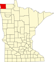 | |
| Townships | ||
| Unorganized territories | ||
| Unincorporated communities | ||
| Ghost town | ||