
Yeghegis
- For the nearby town formerly called Yeghegis, see Artabuynk.
39°51′32″N 45°21′41″E / 39.85889°N 45.36139°E
Yeghegis
Եղեգիս | |
|---|---|
 | |
 Yeghegis | |
| Coordinates: 39°51′32″N 45°21′41″E / 39.85889°N 45.36139°E | |
| Country | |
| Province | Vayots Dzor |
| Municipality | Yeghegis |
| Population (2011[1]) | |
| • Total | 369 |
| Time zone | UTC+4 (AMT) |
Yeghegis (Armenian: Եղեգիս; formerly Alayaz, Alagyaz and Erdapin) is a village in the Yeghegis Municipality of the Vayots Dzor Province in Armenia. It has a rich historical past, with the medieval Tsakhats Kar Monastery and the Smbataberd fortress being located in the vicinity of Yeghegis. The name of the town originated from the Armenian word yeghegn which means reed.[2]
Gallery
-
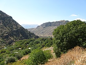 Scenery
 -
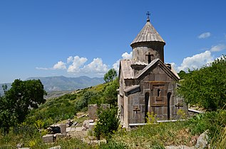 Tsaghats Kar Monastery
 -
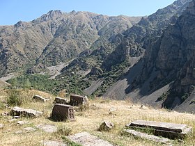
 Adjacent to the Zorats Church
 -
 Zorats Church (also known as St. Stepanos Church)
 -
 Yegheges old cemetery


References
- ^ 2011 population census of the Republic of Armenia
- ^ Kiesling, Brady (2005), Rediscovering Armenia: Guide, Yerevan, Armenia: Matit Graphic Design Studio, see Tsaghats Kar Monastery.
External links
Wikimedia Commons has media related to Yeghegis.
- Yeghegis at GEOnet Names Server
- Report of the results of the 2001 Armenian Census, Statistical Committee of Armenia
- Kiesling, Brady (June 2000). Rediscovering Armenia: An Archaeological/Touristic Gazetteer and Map Set for the Historical Monuments of Armenia (PDF). Archived (PDF) from the original on 6 November 2021.
Capital: Yeghegnadzor | ||
| Urban settlements |  | |
| Areni Municipality | ||
| Jermuk Municipality | ||
| Vayk Municipality | ||
| Yeghegis Municipality | ||
| Yeghegnadzor Municipality | ||
This article about a location in Vayots Dzor Province, Armenia is a stub. You can help Wikipedia by expanding it. |