Southwest Aceh Regency
Southwest Aceh Regency
Kabupaten Aceh Barat Daya | |
|---|---|
 Location within Aceh | |
| Coordinates: 3°47′28″N 96°55′00″E / 3.7911°N 96.9166°E | |
| Country | Indonesia |
| Region | Sumatra |
| Province | Aceh |
| Established | 2002 |
| Regency seat | Blangpidie |
| Government | |
| • Regent | Akmal Ibrahim |
| • Vice Regent | Muslizar |
| Area | |
| • Total | 1,490.60 km2 (575.52 sq mi) |
| Population (mid 2019)[1] | |
| • Total | 149,735 |
| • Density | 100/km2 (260/sq mi) |
| Time zone | UTC+7 (IWST) |
| Area code | (+62) 659 |
| Website | acehbaratdayakab |
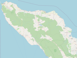
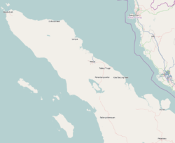
Southwest Aceh Regency (Indonesian: Kabupaten Aceh Barat Daya) is a regency in the Aceh special region of Indonesia. It is located on the island of Sumatra. The regency covers an area of 1,490.6 square kilometres and according to the 2010 census had a population of 126,036; this rose to 140,366 at the 2015 Census, and the latest official estimate (as at mid 2019) is 149,735.[2] The seat of the regency government is at Blangpidie.
Administrative divisions
The regency was divided administratively into nine districts (kecamatan), listed below with their areas and populations at the 2010 Census.[3]
| Name | Area (in km2) |
Population Census 2010 |
No of villages |
|---|---|---|---|
| Babah Rot | 465.8 | 16,419 | 7 |
| Blangpidie | 818.1 | 20,084 | 20 |
| Jeumpa | 15.4 | 9,481 | 10 |
| Kuala Batee | 262.2 | 17,740 | 20 |
| Lembah Sabil | 61.8 | 9.771 | 12 |
| Manggeng | 18.8 | 12,670 | 18 |
| Setia | 11.6 | 7,461 | 6 |
| Susoh | 18.8 | 20,901 | 29 |
| Susoh | 220.7 | 11,509 | 15 |
See also
References


