Berrook, Victoria
Appearance
| Berrook Victoria | |
|---|---|
| Coordinates | 34°57′15″S 141°01′02″E / 34.95417°S 141.01722°E |
| Postcode(s) | 3512 |
| Location | |
| LGA(s) | Rural City of Mildura |
| State electorate(s) | Mildura |
| Federal division(s) | Mallee |
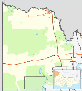
Berrook is a locality situated in remote north-west Victoria in the Sunraysia region. The place by road, about 8 kilometres east from Peebinga South Australia and only about 3 kilometres from the South Australian Border. It can be found by following the Panitya- Berrook unsealed road north for 30 kilometres from Sunset. It is in the local government area of the Rural City of Mildura.
Berrook is near the south-west areas of the Murray-Sunset National Park.
Berrook Post Office opened on 18 February 1929 and closed in 1935.[2]
References
[edit]- ^ Travelmate Archived 24 March 2007 at the Wayback Machine
- ^ Phoenix Auctions History, Post Office List, retrieved 9 February 2021

