Äetsä


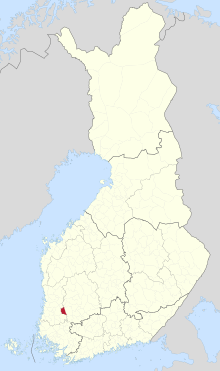
Äetsä is a former municipality of southwestern Finland. The municipality was founded on 1981 when municipalities of Keikyä and Kiikka were consolidated to a single municipality.
On 1 January 2009, it was consolidated with the municipalities of Vammala and Mouhijärvi to form a new city of Sastamala.
Geography
[edit]Äetsä was located in the western Pirkanmaa region, and was part of the former (1997 to 2010) province of Western Finland.
- Demographics
The municipality had a population of 4,797 (November 30, 2008) and covered an area of 241.95 square kilometres (93.42 sq mi), of which 8.38 km2 (3.24 sq mi) was water. The population density was 20.54 inhabitants per square kilometre (53.2/sq mi).
The municipality was unilingually Finnish.
External links
[edit]61°17′05″N 022°41′50″E / 61.28472°N 22.69722°E

