Byron, Ohio

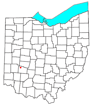
Byron is a small unincorporated community in southeastern Bath Township, Greene County, Ohio, United States. It sits at the intersection of Linebaugh and Dayton-Yellow Springs Roads, between Fairborn and Xenia.[1] Byron is located at 39°47′10″N 83°58′51″W / 39.78611°N 83.98083°W (39.7861705, -83.9807661), at an elevation of 915 feet (279 m).[2]
The community is part of the Dayton Metropolitan Statistical Area.
History
Byron was originally called Tylersville, after President John Tyler, and under the latter name was platted in 1841 on the road running between Yellow Springs and Dayton.[3] The present name honors Lord Byron, an English poet.[4] A post office called Byron was established in 1849, and remained in operation until 1902.[5]
References
- ^ DeLorme. Ohio Atlas & Gazetteer. 7th ed. Yarmouth: DeLorme, 2004, p. 66. ISBN 0-89933-281-1.
- ^ U.S. Geological Survey Geographic Names Information System: Byron, Ohio
- ^ Broadstone, Michael A. (1918). History of Greene County, Ohio: Its People, Industries and Institutions, Volume 1. B.F. Bowen. p. 287.
- ^ Dills, R. S. (1881). History of Greene County: Together with Historic Notes on the Northwest, and the State of Ohio ... Odell & Mayer. p. 239.
- ^ "Greene County". Jim Forte Postal History. Archived from the original on March 12, 2016. Retrieved January 13, 2016.
39°47′10″N 83°58′51″W / 39.78611°N 83.98083°W

