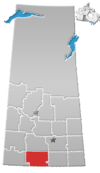
Glenbain
Appearance
Glenbain
(Glen Bain) | |
|---|---|
| Coordinates: 49°50′56″N 107°05′40″W / 49.84889°N 107.09444°W | |
| Country | Canada |
| Province | Saskatchewan |
| Region | south-central |
| Census division | 3 |
| Rural Municipality | Glen Bain |
| Government | |
| • Reeve | Ross Turnbull |
| • Administrator | Marilyn Scheller |
| • Governing body | Glen Bain No. 105[1] |
| Time zone | UTC-6 (CST) |
| Postal code | S0N 0X0 |
| Area code | 306 |
| Highways | Highway 19 |
| Railway | Canadian Pacific Railway |
| [2] | |
Glenbain is a hamlet and seat of Glen Bain Rural Municipality No. 105, Saskatchewan, Canada. It was on mile 53 of the Canadian Pacific Railway right of way, southeast of Swift Current.
See also
References
- ^ "RM of GLEN BAIN No. 10". Municipal Directory System. Government of Saskatchewan. Retrieved September 21, 2017.
- ^ "Geographic Place names - Glenbain". Natural Resources Canada. Government of Canada. Retrieved September 21, 2017.


