Charter Alley
Appearance
| Charter Alley | |
|---|---|
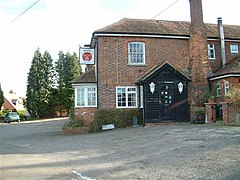
 The White Hart, Charter Alley. | |
Location within Hampshire | |
| District | |
| Shire county | |
| Region | |
| Country | England |
| Sovereign state | United Kingdom |
| Police | Hampshire and Isle of Wight |
| Fire | Hampshire and Isle of Wight |
| Ambulance | South Central |
| UK Parliament | |
Charter Alley is a village in north east Hampshire, England. According to the Post Office the majority of the population at the 2011 Census was included in the civil parish of Wootton St Lawrence. The village was originally known as West Sherbourne and then Charter Ley before becoming Charter Alley.[1]
References
- ^ "The history of Charter Alley". Archived from the original on 17 May 2006. Retrieved 16 May 2010.
- The geographic coordinates are from the Ordnance Survey.
External links
![]() Media related to Charter Alley at Wikimedia Commons
Media related to Charter Alley at Wikimedia Commons


