
Madhur
Madhur | |
|---|---|
Town | |
 Madhur Temple, Kasaragod | |
| Coordinates: 12°30′N 75°00′E / 12.5°N 75.0°E | |
| Country | |
| State | Kerala |
| Region | Kerala |
| District | Kasaragod |
| Nearest Airport(s) | Mangaluru Airport, Kannur International Airport, Calicut International Airport |
| Area | |
| • Total | 110 km2 (40 sq mi) |
| Elevation | 19 m (62 ft) |
| Languages | |
| • Administrative | Malayalam |
| • Other | Kannada, Tulu |
| Time zone | UTC+5:30 (IST) |
| PIN | 671121 |
| Telephone code | 91–4994 |
| Vehicle registration | KL-14 |
Madhur is a temple town located in Kasaragod district of Kerala, India.
Location
Madhur town is located to the East of Kasaragod at a distance of 5 kilometers.[1]
Madhur Temple
Madhur Temple is one of the biggest temples of Kasaragod district. Its peculiar spherical shape and the riverside location gives it a unique charm. A large number of visitors come to see the temple from Karnataka and Tamil Nadu.[2]
Image gallery
-
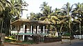 Sunni mosque in Madhur
 -
 Kilr Masjidh
 -
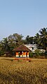 Farmer's God
 -
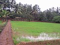 Madhur village


