The Trundle
| The Trundle | |
|---|---|
 View of the Trundle | |
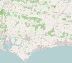
| Location | The Trundle in West Sussex, England |
| Coordinates | 50°53′33″N 0°45′14″W / 50.892585°N 0.753894°W |
| OS grid reference | SU87771103 |
| Area | 5.66 hectares (14.0 acres) |
| Built | Iron Age |
| Reference no. | 246354[1] |
The Trundle (Old English: Tryndel, meaning "circle")[2][1] is an Iron Age hill fort on Saint Roche's Hill about 3 miles (5 km) north of Chichester, Sussex, England. The fort was built around a Neolithic causewayed enclosure, of which very little can be seen on the ground.
History
St Roche's Hill (elevation 675 feet (206 m)) has been used for several purposes, dating back to the Palaeolithic era. The hill fort was a Neolithic causewayed enclosure before the Iron Age hill fort was built around the pre-existing structure. It is unknown for what purpose the fort was originally built, but the site was used in 1645 by the Clubmen as a military base and subsequently as a beacon site to warn against attack by the French. This beacon was lit in 1745, causing much alarm in the surrounding countryside.[3]
The hill was also the site of a small (around 11 ft × 14 ft (3.4 m × 4.3 m)) chapel, until it was left to ruin. It is thought the chapel was built at some point in the 15th century and destroyed during the Reformation.[3] A windmill was also present on the site of the hill-fort. It is not known when it was built, but in 1773, the windmill burnt down in a storm, along with a windmill on Portsdown Hill.
In World War II, it was the site for a radar early warning system.[4] The summit of St Roche's Hill is now the site of two large radio masts.[2]
The Trundle's northeast slope is a viewing area for Goodwood Racecourse and the top of the hill offers panoramic views of parts of Sussex, Hampshire and the English Channel beyond.[3] In June/July 2010, The Trundle was temporary host to 'Artemis', a 30 ft tall bronze sculpture of a horse designed by sculptor Nic Fiddian-Green.[5][6] The sculpture was taken to Australia in 2011.[7]
Archaeological excavations
During archaeological excavations (1928–1930, 1975, 1980, 1987, 1989 and 1994–95)[8] of the hill fort, numerous objects have been discovered: Middle Iron-Age pottery, potboilers, human bones (an arm bone and a skull), animal bones (ox, horse, pig, dog, cat and sheep), charcoal, various iron objects (including a knife, a spearhead, an adze blade, a sickle, large iron rings and iron slag) and several quern-stone fragments.
See also
References
- ^ a b "The Trundle". National Monuments Record. English Heritage. Retrieved 8 March 2011.
- ^ a b "The Megalithic Portal: The Trundle". Retrieved 16 March 2015.
- ^ a b c "West Sussex.info". Retrieved 16 March 2015.
- ^ "The Trundle". English Heritage.
- ^ "35ft horse's head sculpture graces South Downs". The Argus. 15 December 2010. Retrieved 16 March 2015.
- ^ "Art (visual arts only),Sculpture (Art and design),Art and design,Culture,Horse racing". The Guardian. London. 29 June 2010.
- ^ "Sculpture leaves Goodwood for new home Down Under". Midhurst and Petworth Observer. 8 November 2011. Retrieved 5 March 2013.
- ^ "English Heritage: The Trundle: Investigation history". Retrieved 16 March 2015.

