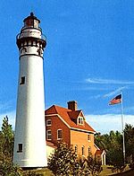
Calumet Light
Appearance
 Calumet Harbor Light | |
 | |
| Location | Calumet, Wisconsin |
|---|---|
| Coordinates | 43°54′54″N 88°19′56.5″W / 43.91500°N 88.332361°W |
| Tower | |
| Constructed | 1936 |
| Construction | Steel skeletal |
| Height | 21 m (69 ft) |
| Light | |
| Focal height | 23 m (75 ft) |
| Lens | Strobes |
| Characteristic | 2 flashing white |
The Calumet Harbor lighthouse is a three-story, open-air lighthouse and observation tower located in Calumet Harbor, in the town of Calumet, Wisconsin, approximately one mile west of Pipe, Wisconsin. It is located on the eastern shore of Lake Winnebago, inside the Columbia Park, a Fond du Lac County park. The structure is a steel skeletal tower with two flashing white strobe lights located on top.[1][2]
Notes
Further reading
- Havighurst, Walter (1943) The Long Ships Passing: The Story of the Great Lakes, Macmillan Publishers.
- Oleszewski, Wes, Great Lakes Lighthouses, American and Canadian: A Comprehensive Directory/Guide to Great Lakes Lighthouses, (Gwinn, Michigan: Avery Color Studios, Inc., 1998) ISBN 0-932212-98-0.
- Pepper, Terry. "Seeing the Light: Lighthouses on the western Great Lakes". Archived from the original on 2008-01-30.
- Wright, Larry and Wright, Patricia, Great Lakes Lighthouses Encyclopedia Hardback (Erin: Boston Mills Press, 2006) ISBN 1-55046-399-3.
External links
- Rowlett, Russ. "Lighthouses of the United States: Eastern Wisconsin". The Lighthouse Directory. University of North Carolina at Chapel Hill.
- "Historic Light Station Information and Photography: Wisconsin". United States Coast Guard Historian's Office. Archived from the original on 2017-05-01.

