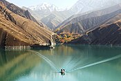
Sumbar Dam
| Sumbar Dam | |
|---|---|
| Country | Iran |
| Location | Gholaman, North Khorasan Province |
| Coordinates | 38°03′59.6″N 057°09′41.7″E / 38.066556°N 57.161583°E |
| Purpose | Flood control, municipal, irrigation water |
| Status | Operational |
| Dam and spillways | |
| Type of dam | Embankment, rock-fill |
| Height | 23 m (75 ft) |
| Length | 900 m (3,000 ft) |
| Elevation at crest | 1,342 m (4,403 ft) |
| Reservoir | |
| Total capacity | 16,200,000 m3 (13,100 acre⋅ft) |
The Sumbar Dam is a rock-fill embankment dam just east of Gholaman in North Khorasan Province, Iran. The primary purpose of the dam is flood control and water supply for irrigation and municipal uses.[1]
References
- ^ Barani, H. R. Rostami; Khatib, M. M. (8 January 2015). "Back Analysis of Grout Treatment at Sumbar Dam Using the Joint Hydraulic Factor". Rock Mechanics and Rock Engineering. 48 (6): 2485–2488. doi:10.1007/s00603-014-0706-6. ISSN 0723-2632.


