Kurit Dam
Appearance
| Kurit Dam | |
|---|---|
| Location | Tabas, Tabas County, South Khorasan Province, Iran |
| Coordinates | 33°26′11″N 57°14′31″E / 33.43639°N 57.24194°E |
| Construction began | 14th century |
| Dam and spillways | |
| Type of dam | Arch, masonry |
| Height | 64 metres (210 ft) |
| Length | 29 metres (95 ft) |
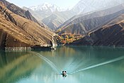
The Kurit Dam is a masonry arch dam located 34 km southeast of Tabas, Iran near the village of Kurit. The dam is an early arch dam constructed by the Mongolians around 1350 AD. The dam was originally 60m tall but 4m of height was added in 1850. The dam was constructed in a very narrow gorge and was the tallest in the world up until the early 20th century.[1] The dam also contained a water outlet system considered sophisticated for its time.[2] Currently, the dam does not impound a reservoir and a large segment of its lower downstream face has fallen off. Behind the dam, where the reservoir existed, is now full of silt with the exception of directly behind the upstream face which has been excavated.[3]
References
- ^ "Key Developments in the History of Arch Dams". SimScience. Archived from the original on July 28, 2012. Retrieved 20 September 2018.
- ^ Hubert Chanson, Patrick JAMES (2004). "Historical Development of Arch Dams". TRAIANVS. Retrieved 19 July 2010.
- ^ Tančev, Ljubomir (2005). Dams and appurtenant hydraulic structures. Taylor & Francis. p. 501. ISBN 90-5809-586-X.


