
Moravský Beroun
Moravský Beroun | |
|---|---|
Town | |
 | |
 Coat of arms | |
 Moravský Beroun Location in the Czech Republic | |
| Coordinates: 49°47′47″N 17°26′41″E / 49.79639°N 17.44472°E | |
| Country | Czech Republic |
| Region | Olomouc |
| District | Olomouc |
| Municipality | Moravský Beroun |
| Government | |
| • Mayor | Tomáš Feranec |
| Area | |
| • Total | 51.22 km2 (19.78 sq mi) |
| Elevation | 525 m (1,722 ft) |
| Population (2012-01-01) | |
| • Total | 3,189 |
| • Density | 62/km2 (160/sq mi) |
| Time zone | UTC+1 (CET) |
| • Summer (DST) | UTC+2 (CEST) |
| Postal code | 793 05 |
| Website | www.morberoun.cz |
Moravský Beroun (Czech pronunciation: [ˈmorafskiː ˈbɛroun]; German: Bärn) is a town in the Olomouc District, Olomouc Region, Czech Republic. It has 3,322 inhabitants (2006 estimation).
History
This section needs expansion. You can help by adding to it. (January 2013) |
Until 1918, Bärn (named Baern before 1867) was part of the Austrian monarchy (Austria side after the compromise of 1867), in the Sternberg (Šternberk) district, one of the 34 Bezirkshauptmannschaften in Moravia.[1]
In 1938, after the Munich Agreement, it was annexed by Nazi Germany as one of the municipalities in Reichsgau Sudetenland, one of the 6 towns of Landkreis Bärn.[2] The German-speaking population was expelled in 1945 (further to the Beneš decrees) and replaced by Czech settlers, who renamed the town.
Gallery
-
 Road
Road -
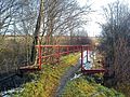 Footbridge
 -
 Ecce homo


References
External links
- (in Czech) Official website
| International | |
|---|---|
| National | |
This Olomouc Region location article is a stub. You can help Wikipedia by expanding it. |