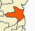
Karaimedu
Appearance
Karaimedu
Periya Karaimedu | |
|---|---|
Village | |
| Nickname: Periya Karaimedu | |
| Coordinates: 11°49′07″N 79°43′52″E / 11.8186°N 79.7310°E | |
| Country | |
| State | Tamil Nadu |
| District | Cuddalore |
| Taluk | Cuddalore |
| Block | Cuddalore |
| Languages | |
| • Official | Tamil |
| Time zone | UTC+5:30 (IST) |
| Vehicle registration | TN-31 |
Karaimedu is a revenue village in Cuddalore district, state of Tamil Nadu, India.[1][2] Karaimedu is a small village, which is 2.5 km away from Bahour with more than one hundred families lives there. The village is situated in the southern border of Bahour lake.
References
- ^ "Sirkali taluk Map, Nagapattinam , Tamil Nadu". Retrieved 10 October 2013. [dead link]
- ^ "List of revenue villages in Sirkali taluk, Tamil Nadu". Retrieved 10 October 2013.
External links


