
Toimi, Minnesota
Toimi, Minnesota | |
|---|---|
 Toimi Location in Minnesota  Toimi Location in the United States | |
| Coordinates: 47°24′02″N 91°46′04″W / 47.40056°N 91.76778°W | |
| Country | United States |
| State | Minnesota |
| County | Lake |
| Elevation | 1,749 ft (533 m) |
| Population | |
| • Total | 10 |
| Time zone | UTC-6 (Central (CST)) |
| • Summer (DST) | UTC-5 (CDT) |
| Area code | 218 |
| GNIS feature ID | 658704[1] |
Toimi is an unincorporated community in Lake County, Minnesota, United States.
The community is located 31 miles north of the city of Two Harbors at the intersection of Lake County Highway 15 and Lake County Road 151 (Etelainen Road). Toimi is located 29 miles west of Silver Bay, and 27 miles southeast of Hoyt Lakes. The boundary line between Lake and Saint Louis counties is nearby.
Toimi is located within the Superior National Forest, and also located within Lake No. 2 Unorganized Territory of Lake County.
Store Creek flows through the community. Lake County Highway 2 is in the area.
The unincorporated communities of Fairbanks and Brimson are nearby.
References
Municipalities and communities of Lake County, Minnesota, United States | ||
|---|---|---|
| Cities | 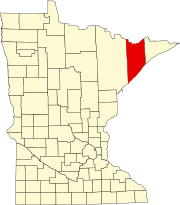 | |
| Townships | ||
| CDPs | ||
| Other communities | ||
| Unorganized territories | ||
| Ghost town | ||
This article about a location in Lake County, Minnesota is a stub. You can help Wikipedia by expanding it. |