Pácsony
Appearance
Pácsony | |
|---|---|
| Coordinates: 47°00′57″N 16°51′19″E / 47.01581°N 16.85530°E | |
| Country | Hungary |
| Region | Western Transdanubia |
| County | Vas |
| Subregion | Vasvári |
| Rank | Village |
| Area | |
| • Total | 10.01 km2 (3.86 sq mi) |
| Population (1 October 2011)[2] | |
| • Total | 272 |
| • Density | 27/km2 (70/sq mi) |
| Time zone | UTC+1 (CET) |
| • Summer (DST) | UTC+2 (CEST) |
| Postal code | 9823 |
| Area code | +36 94 |
| KSH code | 07162[1] |
| Website | http://www.pacsony.hu/ |
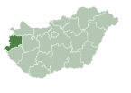
Pácsony is a village in Vas county, Hungary.
References
- ^ a b Pácsony at the Hungarian Central Statistical Office (Hungarian).
- ^ "Pácsony (Vasvár, Vas, Hungary) - Population Statistics, Charts, Map, Location, Weather and Web Information". www.citypopulation.de. Retrieved 2019-03-26.
47°01′N 16°52′E / 47.017°N 16.867°E


