Qleiat
Qleiat
قليعات | |
|---|---|
Village | |
| Coordinates: 33°58′21″N 35°42′50″E / 33.972435°N 35.714025°E | |
| Country | |
| Governorate | Mount Lebanon |
| District | Keserwan |
| Area | |
| • Total | 6.46 km2 (2.49 sq mi) |
| Elevation | 1,050 m (3,440 ft) |
| Time zone | UTC+2 (EET) |
| • Summer (DST) | UTC+3 (EEST) |
| Dialing code | +961 |
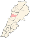
Qleiat (Arabic: قليعات; also spelled Qulaya'at, Qlaiaat, Qliyat, Qleiaat or Kleiat) is a town and municipality in the Keserwan District of the Mount Lebanon Governorate of Lebanon. It is located 28 kilometers north of Beirut. Qleiat's average elevation is 1,050 meters above sea level and its total land area is 646 hectares.[1] Its inhabitants are predominantly Maronite Catholic, with Christians from other denominations in the minority.[2]
Qleiat is today a popular town for its promenade where people can walk, eat and hang out.
The town is a main attraction for families escaping the heat of big cities like Beirut in the summer and settling in Qleiat for its cool weather and active lifestyle. Many popular restaurant chains have opened there as well, like Classic Burger Joint, Crepaway, Lina's, etc.
A big part of Qleiat's population only resides there in the summer and leaves in the winter because of the cold weather and the families leaving for the big cities.
References
- ^ "Qleiaat". Localiban. Localiban. 2008-01-22. Retrieved 2009-07-24.
- ^ "Elections municipales et ikhtiariah au Mont-Liban" (PDF). Localiban. Localiban. 2010. p. 19. Archived from the original (pdf) on 2015-07-24. Retrieved 2016-02-12.


