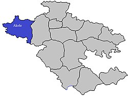
Akole taluka
Appearance
Akole taluka | |
|---|---|
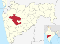
 Location of Akole in Ahmednagar district in Maharashtra | |
| Coordinates: 19°32′32.06″N 74°0′19.88″E / 19.5422389°N 74.0055222°E | |
| Country | |
| State | Maharashtra |
| District | Ahmednagar district |
| Headquarters | Akole |
| Government | |
| • Lok Sabha constituency | Shirdi (Lok Sabha constituency) |
| • Assembly constituency | Akole (Vidhan Sabha constituency) |
| • MLA | Dr. Kiran Yamaji Lahamate |
| Area | |
| • Total | 1,505.0 km2 (581.1 sq mi) |
| Population (2001) | |
| • Total | 271,719 |
| • Density | 180/km2 (470/sq mi) |
| Demographics | |
| • Literacy rate | 59.15 % |
| • Sex ratio | 1.03 ♂/♀ |
| Rain | 1058 mm |
| Website | www |
Akole taluka is a taluka in Ahmednagar district in Maharashtra State of India.[1]
Area
The table below shows area of the taluka by land type.[2]
| Type of Land | Area (km2) | % of Total Area |
|---|---|---|
| Agriculture | 987.12 | 65.59 |
| Forest | 416.98 | 27.7 |
| Other | 100.98 | 6.71 |
| Total | 1505.08 | 100 |
villages
There are around 191 villages in Akole taluka. For list of villages see Villages in Akole taluka.
Population
The table below shows population of the taluka by sex. The data is as per 2001 census.[3]
| Population | % of Total Population | Number of Literate | Literacy (% of Population) | |
|---|---|---|---|---|
| Male | 137617 | 50.65 | 95179 | 69.16 |
| Female | 134102 | 49.35 | 65555 | 48.88 |
| Total | 271719 | 100 | 160734 | 59.15 |
Rain Fall
The Table below details of rainfall from year 1981 to 2004.[4]
| Year | Rainfall (mm) |
|---|---|
| 1981 | 404 |
| 1982 | 396 |
| 1983 | 445 |
| 1984 | 374 |
| 1985 | 184 |
| 1986 | 244 |
| 1987 | 296 |
| 1988 | 734 |
| 1989 | 444 |
| 1990 | 503 |
| 1991 | 544 |
| 1992 | 404.5 |
| 1993 | 636.3 |
| 1994 | 509.8 |
| 1995 | 374 |
| 1996 | 620 |
| 1997 | 587 |
| 1998 | 814.5 |
| 1999 | 403 |
| 2000 | 439 |
| 2001 | 473 |
| 2002 | 445 |
| 2003 | 489 |
| 2004 | 1074 |
See also
References
- ^ "talukas in Ahmednagar district". Archived from the original on 29 September 2011. Retrieved 22 September 2010.
- ^ "talukas geographic information". Archived from the original on 29 September 2011. Retrieved 22 September 2010.
- ^ "talukas population information". Archived from the original on 29 September 2011. Retrieved 22 September 2010.
- ^ "Rainfall information of Ahemadnagar district". Archived from the original on 8 December 2015. Retrieved 22 September 2010.

