Inishmore Aerodrome
Appearance
Inis Mór Aerodrome Aeradróm Inis Mór | |||||||||||
|---|---|---|---|---|---|---|---|---|---|---|---|
 | |||||||||||
| Summary | |||||||||||
| Airport type | Private | ||||||||||
| Operator | Údarás na Gaeltachta Na Forbacha | ||||||||||
| Serves | Inis Mór, Aran Islands, County Galway, Ireland | ||||||||||
| Location | Cill Rónáin | ||||||||||
| Elevation AMSL | 24 ft / 7 m | ||||||||||
| Coordinates | 53°06′25″N 009°39′14″W / 53.10694°N 9.65389°W | ||||||||||
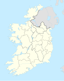
| Map | |||||||||||
| Runways | |||||||||||
| |||||||||||

Inis Mór Aerodrome (IATA: IOR, ICAO: EIIM) is located 1 nautical mile (1.9 km; 1.2 mi) southeast of Kilronan (Irish: Cill Rónáin), a town on the island of Inis Mór (Irish: Inis Mór), one of the Aran Islands off the coast of County Galway in Ireland.[1] It has one paved runway designated 14/32 which measures 490 by 18 m (1,608 by 59 ft).[1]
Service to Connemara Airport is provided by Aer Arann Islands,[2] an airline which also serves the other Aran Islands: Inis Oírr (Irish: Inis Oírr) and Inis Meáin (Irish: Inis Meáin).
In June 2018, the airline announced that it intended to cease operations at the airport in a dispute with the Irish government over funding.[3]
Airlines and destinations
| Airlines | Destinations |
|---|---|
| Aer Arann Islands | Connemara, Inis Oírr, Inis Meáin |
References
- ^ a b c Aerodrome Information - VFR Aerodromes and Heliports Archived 2011-06-15 at the Wayback Machine. Aeronautical Information Service of the Irish Aviation Authority. Effective 2008.
- ^ Aer Arann Islands
- ^ Siggins, Lorna (6 June 2018). "Aer Arann to quit contract for Aran Islands two years ahead of time". The Irish Times. Retrieved 2 September 2018.


