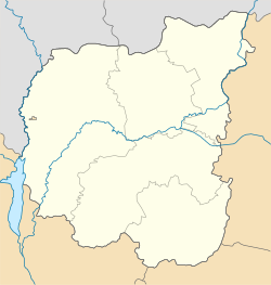
Radul, Ukraine
Radul
Радуль | |
|---|---|
Urban-type settlement | |
| Coordinates: 51°49′52″N 30°42′54″E / 51.83111°N 30.71500°E | |
| Country | Ukraine |
| Oblast | Chernihiv Oblast |
| Raion | Ripky Raion |
| Population (2019) | |
| • Total | 503 |
| Time zone | UTC+2 (EET) |
| • Summer (DST) | UTC+3 (EEST) |
Radul (Ukrainian: Радуль, Russian: Радуль) is an urban-type settlement in Ripky Raion, Chernihiv Oblast, Ukraine. It is located on the left bank of the Dnieper, which here also makes the border between Ukraine and Belarus. Population: Template:Ua-pop-est2019
Economy
Transportation
The closest railway stations (Hlynianka and Holubychi) are located in Ripky. There is infrequent suburban passenger traffic.
Radul is connected to Ripky by a paved road. In Ripky, there is access to Highway M01 which connects Kiev with the border with Belarus and continues across the border to Gomel.

