Derrymullan
Appearance
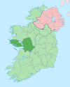
Derrymullan (Irish: Doire an Mhaoláin, meaning 'Mullen's Wood'),[1] also Derrymullen, is a 226-acre townland[2] on the north side of Ballinasloe in County Galway, Ireland. It is in the barony of Clonmacnowen and the civil parish of Kilcloony.
References
[edit]- ^ Derrymullan. Irish Placenames Database. Retrieved: 2010-10-15.
- ^ Townland map Archived 2012-08-29 at the Wayback Machine. Ordnance Survey Ireland. Retrieved: 2010-10-15. Select Historic 6" map for acreage.

