Bhajani
Appearance
Bhajani Municipality
भजनी नगरपालिका | |
|---|---|
| Lua error in Module:Location_map at line 526: Unable to find the specified location map definition: "Module:Location map/data/Nepal Sudurpashchim Pradesh" does not exist. | |
| Coordinates: 28°29′45″N 80°58′54″E / 28.4957°N 80.9816°E | |
| Country | |
| Province | Sudurpashchim Pradesh |
| District | Kailali District |
| Government | |
| • Mayor | Sher Bahadur Chaudhary (NCP) |
| • Deputy Mayor | Chaya Devkota (NCP) |
| Area | |
| • Total | 176 km2 (68 sq mi) |
| Population (2011) | |
| • Total | 52,128 |
| • Density | 300/km2 (770/sq mi) |
| Time zone | UTC+5:45 (NST) |
| Post code | 10900 |
| Area code | 091 |
| Website | www.bhajanitrishaktimun.gov.np |
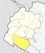
Bhajani is a Municipality in Kailali District in Sudurpashchim Pradesh of Nepal. At the time of the 2011 Nepal censusit had a population of 52,128.[1] It is surrounded by Tikapur Municipality and Joshipur Rural Municipality in the East , Kailari Rural Municipality in the West , Ghodaghodi Municipality in the North and Tikunia, Uttar Pradesh in the South . It is divided into 9 wards .
See also
References
- ^ "Nepal Census 2001", Nepal's Village Development Committees, Digital Himalaya, archived from the original on 12 October 2008, retrieved 15 November 2009.
External links

