
Barenton-Bugny
Barenton-Bugny | |
|---|---|
 The road into Barenton-Bugny | |
Location of Barenton-Bugny  | |
 Barenton-Bugny  Barenton-Bugny | |
| Coordinates: 49°38′02″N 3°39′08″E / 49.6339°N 3.6522°E | |
| Country | France |
| Region | Hauts-de-France |
| Department | Aisne |
| Arrondissement | Laon |
| Canton | Marle |
| Intercommunality | Pays de la Serre |
| Government | |
| • Mayor (2014-2020) | Gérard Bourez |
| Area 1 | 11.38 km2 (4.39 sq mi) |
| Population (2021)[1] | 557 |
| • Density | 49/km2 (130/sq mi) |
| Time zone | UTC+01:00 (CET) |
| • Summer (DST) | UTC+02:00 (CEST) |
| INSEE/Postal code | 02046 /02000 |
| Elevation | 64–96 m (210–315 ft) |
| 1 French Land Register data, which excludes lakes, ponds, glaciers > 1 km2 (0.386 sq mi or 247 acres) and river estuaries. | |
Barenton-Bugny is a commune in the department of Aisne in the Hauts-de-France region of northern France.
The inhabitants of the commune are known as Barentonais or Barentonaises[2]
Geography
Barenton-Bugny is located some 5 km north by north-west of Laon and 8 km south of Crecy-sur-Serre. The Autoroute des Anglais (A26 autoroute) passes through the commune and there is an exit just south of the commune to National Highway N2 which passes north-east though the commune. From National Highway N2 the commune can be accessed on road D546 going north to the village then continuing north-west to intersect the D545 going north to Barenton-Cel. The D513 also goes east from the village to Monceau-le-Waast. There is also the D967 road which passes north-south through the western edge of the commune. Apart from the village and a few patches of forest the commune is entirely farmland with no other villages or hamlets.[3]
The north-western border of the commune is delineated by the Ruisseau de Longedeau which flows into the Ru des Barentons and continues north changing its name a few times before joining the Souche river.[3]
Neighbouring communes and villages[3]
Places adjacent to Barenton-Bugny | |
|---|---|
Administration

List of Successive Mayors of Barenton-Bugny[4]
| From | To | Name | Party | Position |
|---|---|---|---|---|
| 2001 | 2014 | Michel Batteux | DVG | |
| 2014 | Present | Gérard Bourez |
(Not all data is known)
Population
| Year | Pop. | ±% |
|---|---|---|
| 2006 | 570 | — |
| 2007 | 575 | +0.9% |
| 2008 | 580 | +0.9% |
| 2009 | 582 | +0.3% |
| 2010 | 589 | +1.2% |
| 2011 | 578 | −1.9% |
| 2012 | 567 | −1.9% |
| 2013 | 556 | −1.9% |
| 2014 | 551 | −0.9% |
| 2015 | 545 | −1.1% |
| 2016 | 550 | +0.9% |

Sites and Monuments

- The Church of Saint Martin (12th century)
 is registered as an historical monument.[5]
- Picture Gallery
-
 Barenton-Bugny Railway Station
 -
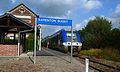 A train at Barenton-Bugny Railway Station


Notable People linked to the commune
- René Blondelle, Senator for Aisne and one of the largest postwar farmers in Barenton-Bugny.
See also
External links
- Barenton-Bugny on the old IGN website (in French)
- Bell Towers website (in French)
- 40000 Bell Towers website (in French)
- Barenton-Bugny on Lion1906
- Barenton-Bugny on Géoportail, National Geographic Institute (IGN) website (in French)
- Baranton Bugny on the 1750 Cassini Map
Notes and references
Notes
References
- ^ "Populations légales 2021" (in French). The National Institute of Statistics and Economic Studies. 28 December 2023.
- ^ Inhabitants of Aisne (in French)
- ^ a b c Google Maps
- ^ List of Mayors of France (in French)
- ^ Ministry of Culture, Mérimée PA00115517 Church of Saint Martin (in French)