Ghodaghodi
Appearance
Ghodaghodi Municipality
घोडाघोडी नगरपालिका | |
|---|---|
| Lua error in Module:Location_map at line 526: Unable to find the specified location map definition: "Module:Location map/data/Nepal Sudurpashchim Pradesh" does not exist. | |
| Coordinates: 28°37′40″N 80°57′54″E / 28.6277°N 80.9650°E | |
| Country | |
| Province | Sudurpashchim Pradesh |
| District | Kailali District |
| Government | |
| • Mayor | Mamata Prasad Chaudhary (NCP) |
| • Deputy Mayor | Prem Kumari Thapa (NCP) |
| Area | |
• Total | 354 km2 (137 sq mi) |
| Population (2011) | |
• Total | 75,965 |
| • Density | 210/km2 (560/sq mi) |
| Time zone | UTC+5:45 (NST) |
| Post code | 10900 |
| Area code | 091 |
| Website | ghodaghodimun |
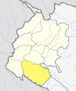
Ghodaghodi Municipality is a Municipality in Kailali District of Sudurpashchim Pradesh. Ghodaghodi lies 58 km east of Dhangadhi and 613 km west of the capital, Kathmandu. It is surrounded by Mohanyal in the North , Bhajani Municipality in the south , Bardagoriya Rural Municipality in the east & Gauriganga Municipality in the west.[1] It is DIvided into 12 wards . It was established by merging Darakh , Sadepani , Ramsikhar Jhala and Pahalmanpur 4 existing Village development committee (Nepal) .[2]

