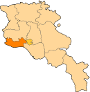
Mayisyan, Armavir
40°09′42″N 44°05′18″E / 40.16167°N 44.08833°E
Mayisyan, Armavir
Մայիսյան | |
|---|---|
| Coordinates: 40°09′42″N 44°05′18″E / 40.16167°N 44.08833°E | |
| Country | Armenia |
| Marz (Province) | Armavir |
| Population (2008) | |
| • Total | 1,642 |
| Time zone | UTC+4 ( ) |
Mayisyan (Armenian: Մայիսյան), is a village in the Armavir Province of Armenia. It was founded as a collective farm (sovkhoz) and named Sovkhoz No.2. Later it became known as Imeni Beriya, named after Lavrentiy Beria. In 1953, it was renamed Imeni Zhdanovaor Zhdanov after Andrei Zhdanov. In 2006, the village was renamed Mayisyan, in memory of the Armenian victory over the Turks during the battles of Abaran and Sardarabad in May 1918.
See also
References
- Mayisyan, Armavir at GEOnet Names Server
- World Gazeteer: Armenia – World-Gazetteer.com
- Report of the results of the 2001 Armenian Census, Statistical Committee of Armenia
- Kiesling, Brady (June 2000). Rediscovering Armenia: An Archaeological/Touristic Gazetteer and Map Set for the Historical Monuments of Armenia (PDF). Archived (PDF) from the original on 6 November 2021.


