Shaler Mountains
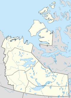
Location in the Northwest Territories and Nunavut
The Shaler Mountains are a mountain range that cross the Northwest Territories-Nunavut border on north-central Victoria Island, Canada. Although located partly in Nunavut the majority of the range lies in the Northwest Territories.[1] Its highest point is 655 m (2,149 ft), making it the highest point on Victoria Island.[2]
References
- ^ "Shaler Mountains". Geographical Names Data Base. Natural Resources Canada. Retrieved 2020-10-25.
- ^ "Canadian Arctic - Victoria Island". Archived from the original on December 23, 2010. Retrieved 2009-03-14.
{{cite web}}: CS1 maint: bot: original URL status unknown (link)

