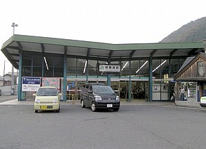
Sagamiko Station
JC25 Sagamiko Station 相模湖駅 | ||||||||||||||||||||||||||||
|---|---|---|---|---|---|---|---|---|---|---|---|---|---|---|---|---|---|---|---|---|---|---|---|---|---|---|---|---|
 Exit of Sagamiko Station | ||||||||||||||||||||||||||||
| General information | ||||||||||||||||||||||||||||
| Location | Yosei, Midori, Sagamihara, Kanagawa (相模原市緑区与瀬1395) Japan | |||||||||||||||||||||||||||
| Operated by | East Japan Railway Company | |||||||||||||||||||||||||||
| Line(s) | Chūō Main Line | |||||||||||||||||||||||||||
| Connections |
| |||||||||||||||||||||||||||
| History | ||||||||||||||||||||||||||||
| Opened | 1901 | |||||||||||||||||||||||||||
| Previous names | Yosei (until 1956) | |||||||||||||||||||||||||||
| Passengers | ||||||||||||||||||||||||||||
| 2011 | 3,293 daily | |||||||||||||||||||||||||||
| Services | ||||||||||||||||||||||||||||
| ||||||||||||||||||||||||||||
Sagamiko Station (相模湖駅, Sagamiko-eki) is a railway station on the Chūō Main Line of East Japan Railway Company in Midori-ku, Sagamihara, Kanagawa Prefecture, Japan. The station is 62.6 rail kilometers from Tokyo Station.
Station history
Sagamiko Station first opened on August 1, 1901, as Yosei Station (与瀬駅, Yosei-eki) for both freight and passenger service on the Japanese Government Railways (JGR) Chūō Line. The JGR became the JNR after the end of World War II. The station was renamed to its present name on April 10, 1956.
Regularly scheduled freight services were discontinued in 1971, and parcel services on November 16, 1961. With the dissolution and privatization of the JNR on April 1, 1987, the station came under the control of the East Japan Railway Company. Automated turnstiles using the Suica IC Card system came into operation from November 18, 2001.
Lines
Layout
Sagamiko Station has a single island platform and a side platform serving three tracks, connected to the station building by an overpass. The middle platform (Platform 2) is used only for through traffic.
Platforms
| 1 | ■ Chūō Main Line | Ōtsuki ・ Kōfu ・ Kobushisawa |
| 2 | ■ Chūō Main Line | through trains |
| ■ Chūō Main Line | Takao ・ Tachikawa ・ Shinjuku ・ Tokyo |
References
- Kozo, Miyoshi (2009). Chuo-sen Machi to eki Hyaku-niju nen (in Japanese). JT Publishing. ISBN 453307698X.
External links
- Official home page.(in Japanese)
