Bealadangan
Béal an Daingin
Bealadangan | |
|---|---|
Village | |
 Shop and post office at Béal an Daingin | |
| Coordinates: 53°18′50″N 9°36′59″W / 53.3138°N 9.6163°W | |
| Country | Ireland |
| Province | Connacht |
| County | County Galway |
| Elevation | 1 m (3 ft) |
| Irish Grid Reference | L922305 |
| As this is a Gaeltacht village, the Irish Béal an Daingin is the only official name. The anglicized spelling Bealadangan has no official standing. | |
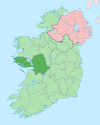
Béal an Daingin or Béal a' Daingin (anglicized as Bealadangan) is a small Gaeltacht[1] village in Connemara (Conamara), County Galway, Ireland. The primary spoken language is Irish, and all but a few of the elderly population also speak English. There is a pub, a post office and a primary school (Toureen) within a few miles of the village.
Local traditions include the continued cutting of turf (peat) for use in heating homes. Sean-nós singing is still performed locally. Raidió na Gaeltachta is the local Irish-language radio station and some local singers and musicians can be heard on the station.[citation needed]
The name of the village derives from the Irish béal an daingin meaning the mouth of the stronghold.
Other nearby villages are Leitir Móir and An Cheathrú Rua.
Notable people
- Diarmuid Mac an Adhastair (1944-2015), actor who portrayed the character Seamus Mhicil Tom on the TV drama, Ros na Rún.[2]


