Action Airpark
Action Airpark | |||||||||||
|---|---|---|---|---|---|---|---|---|---|---|---|
| Summary | |||||||||||
| Airport type | Public use | ||||||||||
| Owner | Bill P. Fisher | ||||||||||
| Serves | Greendale / Lawrenceburg | ||||||||||
| Location | Hardinsburg, Dearborn County, Indiana | ||||||||||
| Closed | After 1997 | ||||||||||
| Elevation AMSL | 465 ft / 142 m | ||||||||||
| Coordinates | 39°08′12″N 84°49′46″W / 39.13667°N 84.82944°W | ||||||||||
| Map | |||||||||||
 | |||||||||||
| Runways | |||||||||||
| |||||||||||
| Statistics (1997) | |||||||||||
| |||||||||||
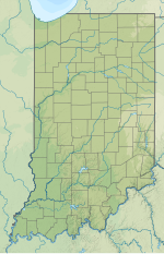
Action Airpark (FAA LID: I38) was a privately owned, public use ultralight airport in Dearborn County, Indiana, United States.[1] As per FAA records, it was one nautical mile (2 km) northeast of the central business district of Hardenstown, Indiana.[1] The airpark was near Hardinsburg, an unincorporated town in Lawrenceburg Township, near the cities of Greendale and Lawrenceburg.[2][3]
Facilities and aircraft
[edit]Action Airpark covered an area of 18 acres (7 ha) at an elevation of 465 feet (142 m) above mean sea level. It had one runway designated 2/20 with a turf surface measuring 1,577 by 100 feet (481 x 30 m).
For the 12-month period ending August 18, 1997, the airport had 436 aircraft operations, an average of 36 per month: 97% general aviation and 3% military. At that time there was one ultralight aircraft based at this airport.
See also
[edit]References
[edit]- ^ a b c FAA Airport Form 5010 for I38 PDF. Federal Aviation Administration. effective July 31, 2008.
- ^ "Map showing Action Airpark". Google Maps. Retrieved August 8, 2013.
- ^ "Map showing Action Airpark". MapQuest. Retrieved August 8, 2013.
External links
[edit]- Aerial image as of March 1999 from USGS The National Map
- Aeronautical chart at SkyVector

