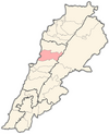
Ain el-Rihaneh
Appearance
Ain er-Rihaneh
عين الريحانة | |
|---|---|
Municipality | |
| Country | |
| Governorate | Mount Lebanon |
| District | Keserwan |
| Area | |
| • Total | 2.05 km2 (0.79 sq mi) |
| Elevation | 340 m (1,120 ft) |
| Time zone | UTC+2 (EET) |
| • Summer (DST) | UTC+3 (EEST) |
Ain er-Rihaneh (Arabic: عين الريحانة; also spelled Ayn ar-Rihanah or Aain er-Rihane) is a town and municipality located in the Keserwan District of the Mount Lebanon Governorate of Lebanon. The town is about 21 kilometres (13 mi) north of Beirut.[1] It has an average elevation of 340 meters above sea level and a total land area of 205 hectares.[1] Ain er-Rihaneh's inhabitants are Maronites.[2] The village contained two private schools enrolling a total of 201 students as of 2006.[1]
References
- ^ a b c "Ain Er Rihaneh". Localiban. Localiban. 2008-01-19. Retrieved 2016-02-26.
- ^ "Elections municipales et ikhtiariah au Mont-Liban" (pdf). Localiban. Localiban. 2010. p. 19. Retrieved 2016-02-26.

