Al-Kharj
Al-Kharj
الخرج | |
|---|---|
 King Abdul Aziz Al-Kharj Castle in Al-Kharj | |
| Coordinates: 24°08′54.0″N 47°18′18.0″E / 24.148333°N 47.305000°E | |
| Country | |
| Province | Riyadh Region |
| Government | |
| • Acting Governor | Musaad Bin Abdullah Bin Saad Almadhi |
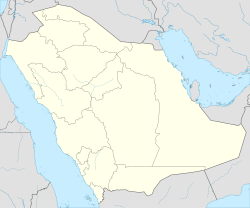
Al Kharj (Arabic: الخرج), also known locally as Al Saih (Arabic: السيح), is a city in Al Kharj Governorate in central Saudi Arabia. Al Kharj is 77 km south of Riyadh.


It is connected by rail to both Riyadh and Dammam.[1] The city's main landmarks includes the historical water wells, and King Abdulaziz Palace and Mosque.[2]
Under the leadership of King Abdulaziz, who first took initiative for the production of milk in the kingdom, an experimental farm was established at Al-Kharj in 1938.[3]
2016 Al-Kharj was a closed city. The state-onwed armor manufacturer Military Industries Corporation (MIC) was situated in the city, where the German assault rifle Heckler & Koch G36 was mounted and the matching 5.56mm ammunition produced.[4]
References
- ^ "Al-Kharj". Saudiembassy.net. Archived from the original on 20 December 2014. Retrieved 19 December 2014.
{{cite web}}: Unknown parameter|dead-url=ignored (|url-status=suggested) (help) - ^ Rashid Hassan (9 June 2014). "Al-Kharj expo promotes cultural values". Arab News. Retrieved 20 December 2014.
- ^ "Al-Kharj". Encyclopædia Britannica. Encyclopædia Britannica Online. Retrieved 2016-08-13.
- ^ Otfried Nassauer: Hemmungslos in alle Welt. Die Munitionsexporte der Rheinmetall AG, Heinrich-Böll-Stiftung, October 2016
24°8′54″N 47°18′18″E / 24.14833°N 47.30500°E.

