Ashuradeh
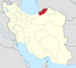
Ashūradeh (Persian: آشوراده), or Ashur Ada (Russian: Ашур-Ада), is the only island of the Iranian coast of the Caspian Sea. Ashuradeh's surface is 800 hectares (2,000 acres). It is located on the eastern end of the Miankaleh peninsula in the county of Behshahr of Māzandarān Province of Iran, 3 kilometers (1.9 mi) from Bandar Torkaman and 23 kilometers (14 mi) from Gorgan.[1]
The island can be reached via Bandar Torkaman. Over 40% of Iran's caviar is produced near Ashūradeh Island.[2]
History
Ashuradeh was formerly inhabited by 300 families, but the village is now deserted. This island was occupied by Russian forces in 1837 despite protests from Persia.[3] Following the occupation, the Russian Army maintained a military post on the island for a few decades.[4]
References
External links
36°50′N 53°51′E / 36.833°N 53.850°E

