Auchinstarry
| Auchinstarry | |
|---|---|
 Forth and Clyde Canal near Auchinstarry | |
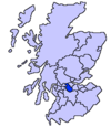
Location within North Lanarkshire | |
| OS grid reference | NS7276 |
| Council area | |
| Lieutenancy area | |
| Country | Scotland |
| Sovereign state | United Kingdom |
| Police | Scotland |
| Fire | Scottish |
| Ambulance | Scottish |
| UK Parliament | |
| Scottish Parliament | |
Auchinstarry is a village in North Lanarkshire, Scotland, UK, near to Dullatur, Kilsyth and Queenzieburn. It is the site of a Roman fort.
Auchinstarry Basin is on the Forth and Clyde Canal, and a £1.2m regeneration project has created a mooring basin for boats with 56 pontoon berths, a hard standing area for 40 boats, and a customer facilities block, partly funded by British Waterways Scotland. The basin was officially opened in September 2005.
The Environment Advisory Service (EAS), a government agency, has implemented a number of sustainability features at Auchinstarry Basin:
- Deploying recycled materials in all parts of the construction process
- An innovative pump which draws heat from the canal; it is believed that this is the first such use of canal water in the UK
- Plans for installing wind turbines, and a new pub which is self-sufficient in its energy needs
References
It is also home to Auchinstarry Quarry which is a very popular rock-climbing destination, boasting a very wide range of climbing.
See also
External links
Wikimedia Commons has media related to Auchinstarry.


