Capolat
Capolat | |
|---|---|
 Capolat | |
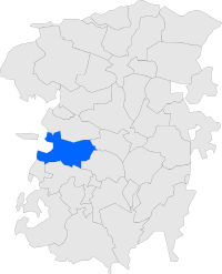
 Map showing location within Berguedà | |
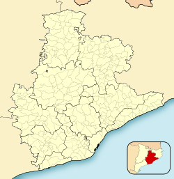
| Coordinates: 42°04′48″N 1°45′16″E / 42.08000°N 1.75444°E | |
| Country | |
| Community | |
| Province | Barcelona |
| Comarca | Berguedà |
| Government | |
| • Mayor | Mireia Besora Sans (2015)[1] (Independents per Capolat) |
| Area | |
| • Total | 34.1 km2 (13.2 sq mi) |
| Elevation | 1,279 m (4,196 ft) |
| Population (2014)[1] | |
| • Total | 88 |
| • Density | 2.6/km2 (6.7/sq mi) |
| Website | www |
Capolat is a municipality in the comarca of Berguedà, Catalonia, Spain.
Economy
The economy is chiefly agricultural, with a particular prevalence of animal husbandry and dryland farming.
Sites of interest
The municipality has three Romanesque churches of interest:
- Church of Sant Salvador de Capolat
- Church of Sant Andreu de la Serreta
- Church of Sant Serni de la Torre
References
- ^ a b "Ajuntament de Capolat". Generalitat of Catalonia. Retrieved 2015-11-13.
- ^ "El municipi en xifres: Capolat". Statistical Institute of Catalonia. Retrieved 2015-11-23.
External links


