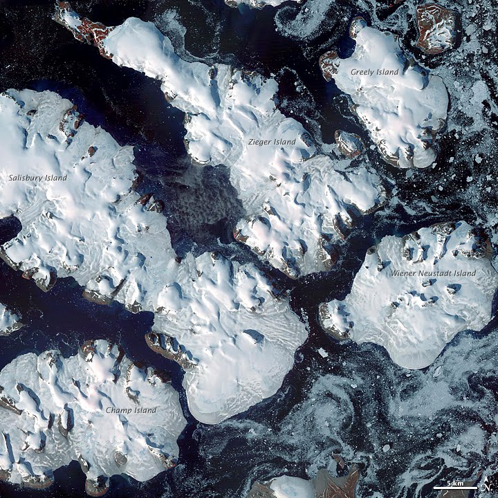
Greely Island
Appearance
 | |
| Geography | |
|---|---|
| Location | Arctic |
| Coordinates | 81°00′16″N 58°17′52″E / 81.0044°N 58.2978°E |
| Archipelago | Franz Josef Archipelago |
| Area | 127 km2 (49 sq mi) |
| Administration | |
| Demographics | |
| Population | 0 |
Greely Island (Russian: Остров Грили; Ostrov Grili) is an island in Franz Josef Land, Russia. Its area is 127 km2 (49 sq mi) and it is almost completely glacierized.
Greely Island is part of the Zichy Land subgroup of the Franz Josef Archipelago. It is separated from Ziegler Island by a narrow sound.
This island was named after American Arctic explorer Adolphus Greely.
81°00′16″N 58°17′52″E / 81.0044°N 58.2978°E
Adjacent Islands
- Ostrov Brosh (Остров Брош), Brosch Island is a large island with unglacierized shores lying off Greely Island's northern coastline. Maximum height 228 m (748 ft). This island was named after Gustav Brosch, a naval lieutenant from Bohemia in the Austro-Hungarian North Pole Expedition. Brosch Island also appears as "Ostrov Kuna" or "Ostrov Kun" in many maps. It was probably renamed by the American Ziegler-Fiala Polar Expedition, perhaps not knowing that it had been named previously by the Austro-Hungarians, in a similar manner as La Ronciere Island.
- Ostrov Keyna (Остров Кейна), Kane Island, is another large partly unglacierized island lying off Greely Island's northeastern shore, southeast of Brosch Island and separated from it by a 2 km (1.2 mi) narrow sound. Maximum height 282 m (925 ft). Kane Island was named after American Arctic explorer Dr. Elisha Kent Kane.
View

See also
References
External links
- Location: [1]
- [2]
- Historical data
