
List of numbered roads in Hastings County
(Redirected from Hastings County Road 4)
This is a list of numbered municipal roads in Quinte West, Belleville and Hastings County, Ontario.
The City of Quinte West and the City of Belleville are single-tier municipalities not under the jurisdiction of an upper-tier municipality such as Hastings County and thus, are outside of the geographic limits of Hastings County for municipal purposes. For geographic purposes however, Quinte West and Belleville are within the geographic limits of Hastings County.[1] The cities form part of the county's census division.
-
 Shield for Tyendinaga Township Road 2
 -
 Diagram of a shield for Wollaston Township Road 620
 -
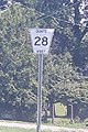 Shield for Quinte West Road 28


List
[edit]| Municipal Road # | Local Name(s) | Southern/Western Terminus | Northern/Eastern Terminus | Settlements served | Additional Notes |
|---|---|---|---|---|---|
| 1 | Wallbridge-Loyalist Road | County Road 2 | County Road 14 | Loyalist College | |
| 2 | Old Highway 2 Dundas Street |
Stoney Point Road | County Road 10 | Trenton, Belleville, Milltown, Marysville, Deseronto | Former King's Highway 2; follows King's Highway 49 from Belleville Road to York Road; a.k.a. Dundas Street in Trenton, Dundas Street in Belleville and Dundas Street in Deseronto |
| 4 | Sidney Street Glenn Miller Road Riverside Parkway |
Dixon Drive, Trenton | County Road 33 | Trenton, Glenn Miller, Frankford | |
| 5 | County Road 5 Mill Street Frankford Road Ashley Street Mudcat Road |
County Road 28 | County Road 41 | Wooler, Stockdale, Frankford, Foxboro | |
| 6 | Blessington Road Read Road Enright Road Deseronto Road |
King's Highway 37 | Scott's Mill Road | Blessington, Read, Albert, Ebenezer | |
| 7 | Shannonville Road | County Road 2 | King's Highway 37 | Blessington, Halston, Chisholms Mills, Roslin | |
| 8 | Hoards Road Campbellford Road Front Street Mill Street Ridge Road Moira Road |
Wingfield Road | King's Highway 37 | Anson, Stirling, West Huntingdon Station, Moira | |
| 10 | Deseronto Road | County Road 2 | Kennelly Road | Deseronto | This road is the boundary between Lennox and Hastings counties. |
| 11 | Deloro Road | King's Highway 7 | King's Highway 62 | Deloro, Malone | |
| 12 | Cooper Road | King's Highway 7 | Bannockburn Road | Hazzards Corners, Rimington, Allen, Cooper | |
| 13 | Marlbank Road Napanee Road |
King's Highway 37 | Youngs Road | Stoco, Larkins, Farrell Corners, Marlbank | |
| 14 | Foxboro-Stirling Road Forsyth Street Main Street Cordova Road |
County Road 5 | Vansickle Road | Foxboro, Stirling, Bonarlaw, Marmora | |
| 15 | Marysville Road Waddingham Road Melrose Road |
Tyendinaga Mohawk Territory | County Road 6 | Lonsdale | Intersects King's Highway 401 at Exit 566; continues as King's Highway 49. |
| 16 | Bayshore Road | King's Highway 49 | County Road 2 | Deseronto | |
| 17 | Point Anne Road | Lane Crescent | County Road 2 | Point Anne | |
| 18 | Airport Parkway | College Street East, Belleville | County Road 7 | Belleville, Belleville Airport | |
| 19 | Wellmans Road | County Road 8 | County Road 14 | Wellman | |
| 20 | Queensborough Road | County Road 12 | King's Highway 7 | Hazzards Corners, Queensborough | |
| 21 | RCAF Road | County Road 2 | County Road 22 | CFB Trenton | |
| 22 | Hamilton Road | County Road 4 | County Road 1 | Trenton | |
| 23 | St. Lawrence Street | King's Highway 7 | King's Highway 7 | Madoc | |
| 24 | Belleville Road | King's Highway 49 | County Road 10 | Marysville | |
| 25 | Flinton Road | King's Highway 7 | Lennox and Addington County limits | Elzevir | |
| 26 | Moneymore Road | County Road 7 | County Road 32 | Chisholms Mills, Moneymore, Coulters Hill | |
| 27 | Maitland Drive Cannifton Road Tank Farm Road |
County Road 30 | King's Highway 37 | Cannifton | |
| 28 | New Wooler Road | Dalmas Road | County Road 40 | none | minor rural route |
| 30 | Sidney Street | County Road 2 | County Road 31 | Belleville | |
| 31 | Vermilyea Road | County Road 1 | King's Highway 62 | none | minor connecting route |
| 32 | Napanee Road | County Road 3 | Cold Water Road | Marlbank | |
| 33 | Loyalist Parkway Carrying Place Road Dufferin Avenue Dundas Street West Division Street Front Street Water Street Trenton Street Trenton-Frankford Road Trent Street Mill Street River Drive Frankford-Stirling Road |
Old Portage Road (continues as Prince Edward County Road 33) |
County Road 8 | Trenton, Frankford, River Valley, Stirling | Formerly part of King's Highway 33 |
| 38 | Spring Brook Road Crookston Road |
Rylstone Road | King's Highway 37 | Spring Brook, Crookston, Tweed | |
| 39 | Sulphide Road | King's Highway 37 | Otter Creek Road | Cosy Cove, Sulphide | |
| 40 | County Road 40 Wooler Road |
County Road 33 | County Road 28 | Highway 401 Exit 522 | |
| 41 | Phillipston Road | King's Highway 37 | County Road 8 | Phillipston, Moira | |
| 62 | Peterson Colonization Road | King's Highway 62 | Schweig Road (continues as Renfrew County Road 62) |
Maynooth, Maple Leaf, Purdy | Formerly part of King's Highway 62 |
| 69 | Kamaniskeg Lake Road Siberia Road |
District Road 62 | Renfrew County limits | none | minor bush route |
| 504 | Highway 504 | Peterborough County Road 504 | Wollaston Township Road 620 | none | Formerly Secondary Highway 504 |
| 517 | Highway 517 | Boulter Road | Coulas Road | Craigmont | |
| 620 | Highway 620 | Peterborough County Road 620 | King's Highway 62 | Coe Hill, Ormsby | Formerly Secondary Highway 620 |
References
[edit]- ^ O. Reg. 180/03: Division of Ontario into Geographic Areas, s. 2, Government of Ontario, retrieved 2020-06-24
| County roads | |
|---|---|
| Regional roads | |
| Municipal roads | |
| See also | |