Lihué Calel National Park
Appearance
You can help expand this article with text translated from the corresponding article in Spanish. (November 2009) Click [show] for important translation instructions.
|
| Lihué Calel National Park | |
|---|---|
| Parque Nacional Lihué Calel | |
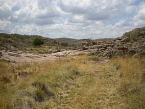
 Sendero Valle de las Pinturas, Lihué Calel National Park | |
 | |
| Location | La Pampa Province, Argentina |
| Coordinates | 37°57′S 65°39′W / 37.95°S 65.65°W |
| Area | 9.901 hectares |
| Established | 1977 |
Lihué Calel National Park (Template:Lang-es) is a national park in Argentina, located in the Lihue Calel Department, in the center of La Pampa Province. Covering 99 square kilometres, it was established in 1977.
External links
 Media related to Parque Nacional Lihué Calel at Wikimedia Commons
