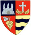
Lipova, Arad
Lipova | |
|---|---|
Town | |
 | |
| Coordinates: 46°5′30″N 21°41′30″E / 46.09167°N 21.69167°E | |
| Country | |
| County | Arad County |
| Status | Town |
| Government | |
| • Mayor | Iosif Mircea Jichici (Social Democratic Party) |
| Population (2002) | |
• Total | 11,126 |
| Time zone | UTC+2 (EET) |
| • Summer (DST) | UTC+3 (EEST) |
| Climate | Cfb |
| Website | http://www.primarialipova.ro |
Lipova (Romanian pronunciation: [ˈlipova]; German and Hungarian: Lippa; Serbian: Липова, Lipova; Turkish: Lipva) is a town in Romania, Arad County, located in the Banat region of western Transylvania. It is situated at a distance of 34 km from Arad, the county capital, at the contact zone of the Mureș River with the Zarand Mountains, Western Plateau and Lipovei Hills. It administers two villages, Radna (Máriaradna) and Șoimoș (Solymosvár), and its total surface is 134.6 square km.
The first written record of the town dates back to 1314 under the name Lipva. In 1324 the settlement was mentioned as castellanus de Lypua, a place-name that reflects its reinforced character of that time.
Population
| Year | Pop. | ±% |
|---|---|---|
| 1930 | 6,000 | — |
| 1948 | 6,556 | +9.3% |
| 1956 | 10,064 | +53.5% |
| 1966 | 11,705 | +16.3% |
| 1977 | 11,863 | +1.3% |
| 1992 | 12,059 | +1.7% |
| 2002 | 11,491 | −4.7% |
| 2011 | 9,648 | −16.0% |
| Source: Census data | ||
According to the census of 2011 the population of the town was 9648 inhabitants. The ethnic groups were: 94% Romanians, 2.89% Hungarians, 1.47% Roma, 1.27% Germans, 0.07% Slovaks, 0.18% Ukrainians and 0.1% of other or undeclared nationalities.
Etymology
Its name is derived from the Slavic word lipa, linden tree with -ova suffix.[1]
History

Situated at the crossing of the roads leading to Transylvania, Banat and Ţara Românească, Lipova had a history full of vicissitudes. It was situated strategically at the Mureș River's exit from the defile, and consequently it was an extremely enviable centre. After the Tartar invasion in 1241 the fortresses were rebuilt, and the lines of the future urban settlement started to get contoured around the castle. Several names of famous historical personalities are related to this castle, such as John Hunyadi, Matthias Corvinus, György Dózsa, Szapolyai János etc. Due to the continuous disputes, the town has become four times under Turk administration (between 1552-1595, between 1613–1686, between 1690-1691 and between 1695-1716), and starting with 1716 it became under Habsburg domination. In the 18th-19th centuries Lipova was a well-developed economic centre with famous craftsmen working here. In the period of the revolution in 1848-49 and in the beginning of the 20th century Lipova became an important centre of political and national emancipation, due to the activity of remarkable personalities, such as Nicolae Bălcescu, Vasile Goldiș, Alexandru Mocioni and Teodor Șerb.
Șoimoș castle has also taken part from the successive vicissitudinary periods related to the historical events of Lipova and to the defensive role of the main entrance gate from Transylvania.
Tourist attractions
The car industry, light industry, services and tourism are the most representative economic sectors. The tourist sites of the town include both natural and anthropic elements. Due to the abundance of tourist attractions, Lipova is an important tourism centre. The natural reservation "Balta Șoimoș", the Șoimoș castle, the monastery called "Saint Mary" in Radna, the church called "Buna Vestire" in Șoimoș, the church named "Adormirea Maicii Domnului", the town museum, the "Sub dughene" bazaar (Turkish bazaar), the environs of the town-hall (Nicolae Bălcescu Street) and the thermal bath where springs with curative mineral water flow.
Natives
- Carmen-Francesca Banciu, novelist
- Ion Vincze, communist activist
- Jovan Nenad, self-declared Emperor of Serbia
References
- ^ Iordan, Iorgu (1963). Toponimia romînească. Bucharest: Editura Academiei Republicii Populare Romîne. p. 99. OCLC 460710897.


