
Monachil
Monachil | |
|---|---|
municipality | |
.svg) Flag  Seal | |
 Location of Monachil | |
| Country | Spain |
| Province | Granada |
| Municipality | Monachil |
| Area | |
| • Total | 90.13 km2 (34.80 sq mi) |
| Elevation | 792 m (2,598 ft) |
| Population (2010) | |
| • Total | 7,294 |
| • Density | 80.9/km2 (210/sq mi) |
Monachil is a municipality in the province of Granada, Spain. As of 2010, it has a population of 7294 inhabitants. It lies around 8 km from the city of Granada. It borders the municipalities of Huétor Vega, Cenes de la Vega, Pinos Genil, Güéjar Sierra, Dílar, La Zubia and Cájar.
Within the municipality of Monachil there are three distinct population centres: the old village, often referred to as Monachil Pueblo, the newer Barrio de la Vega and Pradollano, the resort village at the Sierra Nevada Ski Station. The ski station hosted the Alpine World Ski Championships in 1996, and is due to hold the 2015 Winter Universiade.
The name Monachil comes from the Arabic منستير (monastir), a word of Greek origin meaning "monastery".[1]
-
 Sierra Nevada, Monachil.
 -
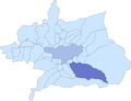 Location of Monachil (in dark blue) relative to the Vega de Granada; The city of Granada is shown in lighter blue.
_5.JPG)

References
- ^ José María Calvo Baeza, Nombres de lugar españoles de origen árabe, Madrid: Darek-Nyumba, 1990.
External links
Wikimedia Commons has media related to Monachil.