Monte Estância
Appearance
| Monte Estância | |
|---|---|
 Monte Estância | |
| Highest point | |
| Elevation | 387 m (1,270 ft) |
| Prominence | 387 m (1,270 ft) |
| Listing | List of mountains in Cape Verde |
| Coordinates | 16°02′48″N 22°45′18″W / 16.04667°N 22.75500°W |
| Geography | |
southeastern Boa Vista | |
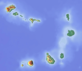
Monte Estância is a mountain in the southeastern part of the island Boa Vista in Cape Verde. At 387 m elevation, it is the island's highest point.[1] It is located 4 km from the Atlantic coast and 23 km southeast of the island capital Sal Rei. It is part of a protected natural space under the statute of natural monument, which covers 739 ha.[1][2]
See also
[edit]References
[edit]- ^ a b Protected areas in the island of Boa Vista - Municipality (and Island) of Boa Vista, March 2013 (in Portuguese)
- ^ Resolução nº 36/2016, Estratégia e Plano Nacional de Negócios das Áreas Protegidas


