Nakatsu River
Appearance
| Nakatsu River | |
|---|---|
 Nakatsu River in Morioka | |
| Native name | 中津川 Error {{native name checker}}: parameter value is malformed (help) |
| Location | |
| Country | Japan |
| Physical characteristics | |
| Source | |
| • location | Kitakami Mountains, Iwate |
| Mouth | Morioka, Iwate |
• location | Kitakami River |
• coordinates | 39°41′44″N 141°08′39″E / 39.69556°N 141.14417°E |
• elevation | 115 m (377 ft) |
| Length | 34.5 km (21.4 mi) |
| Basin size | 208 km2 (80 sq mi) |
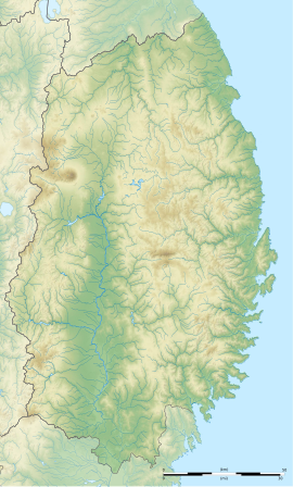
The Nakatsu River (中津川, Nakatsu-gawa) is a river in Iwate Prefecture, Japan. It flows through the city of Morioka, where it enters the Kitakami River.


