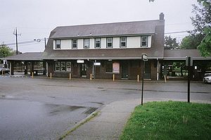
Northport station
Northport | |||||||||||
|---|---|---|---|---|---|---|---|---|---|---|---|
 Northport station | |||||||||||
| General information | |||||||||||
| Location | Larkfield Road & Bellerose Avenue East Northport, New York | ||||||||||
| Coordinates | 40°52′50.57″N 73°19′42.60″W / 40.8807139°N 73.3285000°W | ||||||||||
| Owned by | MTA | ||||||||||
| Line(s) | |||||||||||
| Platforms | 1 side platform | ||||||||||
| Tracks | 1 | ||||||||||
| Connections | |||||||||||
| Construction | |||||||||||
| Parking | Yes; Free, Residential permits, Non-Residential permits, Parking meters, Off-Peak parking | ||||||||||
| Bicycle facilities | Yes | ||||||||||
| Accessible | Yes | ||||||||||
| Other information | |||||||||||
| Fare zone | 9 | ||||||||||
| History | |||||||||||
| Opened | 1873 | ||||||||||
| Rebuilt | 1910 or 1927 | ||||||||||
| Previous names | New Northport (1873–?) Northport East (?–1899) | ||||||||||
| Passengers | |||||||||||
| 2006 | 2,593[1] | ||||||||||
| Services | |||||||||||
| |||||||||||
Northport is a station on the Port Jefferson Branch of the Long Island Rail Road. It is located at the corner of Larkfield Road and Bellerose Avenue, north of Suffolk CR 11 (Pulaski Road) in East Northport, New York. This train station is located in the Northport-East Northport Union Free School District.
History
Northport station was originally built between May and July 1873 as "New Northport" station when the Smithtown and Port Jefferson Railroad was built from Northport Junction to Port Jefferson, New York. The original line which lead directly into a station within Northport Village, since April 25, 1868, became the Northport Branch. Between that period, the original Northport station was renamed Old Northport station, while at some point in or before 1899, "New" Northport station was renamed "Northport East" station. Passenger service ended in 1899. Freight service continued until 1985, when the branch was abandoned.[2][3]
The current station house was rebuilt around 1910, although some sources claim it was in 1927. Regardless of the correct date, it was designed in a manner similar to stations such as those in Riverhead, Bay Shore, Manhasset, and Mineola. It also served as the south end of a trolley Line into Northport from 1902 to 1924.[4][5] A freight house from Camp Upton was moved to Northport Station in April 1922, after the railroad station there was dismantled. High-level platforms and a pedestrian bridge were added during the late-20th Century. Northport Station features two large parking lots. One south of the tracks and the biggest is north of the tracks. A pedestrian bridge is set up between the lots. It is wide enough for the after mentioned south platform to be constructed. Northport is one of the most elaborate LIRR stations. the current station is just east of the Northport Spur, which branched off the main and headed north to the seaport village of Northport, even though the Northport Station is in East Northport. The spur has not seen a passenger train since 1899. Afterward, the spur was entirely used for freight service. freight service ended in 1978. The track lay abandoned until 1985, when it was torn up in preparation for the unbuilt Babylon Northport Expressway.
Station layout
This station has one 12-car-long high-level side platform, north of the track. The Port Jefferson Branch has one track at this location. Directly before the station and lasting until the track runs adjacent to Bellrose Avenue School, a passing siding spurs off from the mainline and runs adjacent to it. The switches are maintained by two position light signals next to the switches. Just east of the station is a siding that is well in use, part of DUKE interlocking. Just east of Larkfield Road, the siding turns south and runs parallel to the main. The siding is used on occasion for train meets, where an eastbound and westbound trains to pass. The second track would eliminate this. DUKE interlocking ends at a switch back to the main.
A second platform, for an extension of the siding, or a full-blown second track, was originally planned for the station. The pedestrian bridge is wide enough for this extra construction, and the bridge's stairway on the far side of the station has a landing on the same level as the unbuilt outbound platform, symmetrical with the landing on the other side which is part of the existing platform. A ticket window was proposed to be established but it has yet to occur.
| Ground/platform level Exit/entrance, parking, pedestrian bridge |
Side platform, doors will open on the left or right | |
| Track 1 | ← Port Jefferson Branch toward Huntington, Jamaica, Atlantic or Penn (Greenlawn) Port Jefferson Branch toward Port Jefferson (Kings Park) → | |
Gallery
-
View of station house, platform and pedestrian bridge
-
Historic marker, placed by the Chamber of Commerce in 2000.
-
Picture taken of the platform from the pedestrian bridge at night.
References
- ^ Average weekday, 2006 LIRR Origin and Destination Study
- ^ Old Northport Spur (Arrt's Arrchives)
- ^ Northport Spur (Unofficial Long Island Railroad History Website)
- ^ Northport Traction Company (Arrt's Arrchives)
- ^ Northport Trolley Line (1902-1924)


