Olivebridge, New York
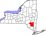
Olivebridge is a hamlet in the Town of Olive, Ulster County, New York, United States, within Catskill Park and the Catskill Mountains.
The community's name is sometimes written Olive Bridge, but the United States Board on Geographic Names gives the name as Olivebridge. (Board decision, 1965)
Olivebridge achieved some notoriety when its tiny government successfully stood up to New York City on several land use/property tax issues, as well as its Town Justice Court rejecting the legal validity of a preemptive 35 mph speed limit imposed on roads surrounding the Ashokan Reservoir by New York City.
The Ashokan-Turnwood Covered Bridge was listed on the National Register of Historic Places in 2000.[1]
References
41°55′40″N 74°12′56″W / 41.9278705°N 74.2154239°W

